





What is an Urban Heat Island?
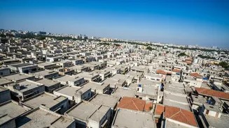
An urban heat island (UHI) occurs when a city experiences much warmer temperatures than nearby rural areas. The reason is simple: our cities are built with materials like concrete, asphalt, and brick that absorb and retain the sun's heat far more than natural
landscapes. These dark surfaces, combined with a lack of green cover and heat generated from cars and industries, can make large cities up to 3°C warmer on average, with some surfaces getting up to 20°C hotter than the surrounding air. This effect is often most noticeable at night, when rural areas cool down but cities continue to radiate the heat they stored during the day.
The High Cost of City Heat
This extra heat isn't just a matter of discomfort; it carries severe consequences, especially in densely populated nations like India. It poses serious public health risks, increasing rates of heat exhaustion and heat stroke, particularly among vulnerable groups like the elderly, children, and outdoor workers. The heat also drives up energy consumption as demand for air conditioning soars, which can strain electricity grids and lead to power failures during the hottest days. This creates a vicious cycle: more AC use releases more waste heat and, if powered by fossil fuels, more greenhouse gases, further intensifying the problem.
How Science Maps the Hot Spots
To combat this, scientists are employing sophisticated tools to create detailed heat maps of our cities. Using data from earth-observing satellites like NASA's Landsat, researchers can monitor surface temperatures across entire metropolitan areas, identifying which neighbourhoods are the hottest. This is complemented by ground-level data from sensor networks and even AI-assisted models that can estimate air temperature block-by-block, providing a more accurate picture of the heat people actually experience. This granular data is crucial because it reveals that heat is not distributed evenly; some neighbourhoods, often those with less green space, bear a much heavier burden.
From Data to Cooler Designs
The goal of this research isn't just to map the problem, but to solve it. Armed with this data, urban planners can implement targeted solutions to cool cities down. These strategies are often surprisingly simple. 'Cool roofs,' which use reflective paint to bounce sunlight back into space, can reduce a building's air conditioning needs by up to 20%. Another powerful tool is increasing green infrastructure. Planting more trees provides shade that can lower surface temperatures dramatically, while parks, green roofs, and urban forests cool the air through a natural process called evapotranspiration.
The Challenge for India's Cities
For India, where rapid urbanisation and intense heatwaves are colliding, these solutions are not a luxury but a necessity. The National Disaster Management Authority (NDMA) has officially declared heatwaves a national disaster, recognising the urgent threat. Cities like Ahmedabad, Chennai, and Pune are already beginning to integrate 'blue-green infrastructure'—linking parks and water bodies to create cooling corridors. Low-cost building interventions, such as painting roofs with a simple lime wash, have been shown to lower indoor temperatures by several degrees. By combining scientific research with smart urban planning, India's cities can work towards becoming more resilient and livable in a warming world.