


Beyond the Blue Dot: Why Your Phone Isn't Enough
In the age of GPS and satellite messengers, it’s easy to feel invincible. Many hikers now rely solely on their phones for navigation, assuming a digital map is all they need. However, this over-reliance is a common mistake that can lead to serious trouble.
Batteries die, especially in the cold. Screens break. Most critically, a GPS dot on a screen doesn't provide true understanding. A topographic map, whether on paper or a downloaded offline app, offers a richer story. It shows the steepness of a slope, the density of a forest, and the likely location of streams—details a simple GPS app might miss. Learning to read these contour lines helps you identify ridges, valleys, and potential hazards before you encounter them. It’s the difference between knowing where you are and understanding where you are.
Reading the Land for Survival
When you're lost or stranded, the landscape becomes your lifeline. A strong knowledge of local geography and terrain can help you make critical survival decisions. For instance, understanding topography helps you identify the safest routes to avoid dangers like flash floods in low-lying areas or exposure on high ridges during a storm. Need water? A topographic map can point you toward drainage areas where streams are likely to flow. Need shelter? Knowing that the leeward side of a ridge offers protection from wind can be a game-changer. This geographical awareness allows you to see the terrain not as an obstacle, but as a resource. It transforms your surroundings from a source of fear into a map of solutions for finding water, shelter, and a safer place to await rescue.
The Psychology of Being Lost
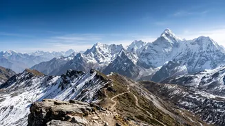
Panic is one of the greatest dangers in a wilderness emergency. When disorientation sets in, the first instinct is often to keep moving, which can lead hikers further into unknown territory and make it harder for search teams to find them. This is where geographical familiarity plays a vital mental role. If you’ve studied the area beforehand, you can recognise prominent landmarks like a distinct peak or a major river. This process of landmarking helps you stay oriented, reduces feelings of being hopelessly lost, and allows for calmer, more rational decision-making. Even a general sense of the region’s layout—knowing a major road is to the east, for example—can provide a psychological anchor, encouraging you to stay put and conserve energy, which is often the safest course of action.
Aiding Your Own Rescue
If you are able to make contact with a search and rescue (SAR) team, the information you provide is crucial. Simply saying “I’m lost on the trail” is not enough. However, if you can describe your location using local geography, your chances of a swift rescue increase dramatically. Being able to say, “I’m in a valley west of the Three Sisters peak, near a fast-flowing stream running south” gives rescuers a precise search area. Using local place names, identifying surrounding terrain features, or providing a grid reference from a map app are all invaluable. This knowledge helps SAR teams plan their approach, whether by ground or air, and understand the terrain they will be facing, ultimately making your rescue faster and safer for everyone involved.
How to Prepare Before You Leave
Building your geographical intelligence starts long before you set foot on the trail. First, research your route thoroughly using detailed topographic maps. Identify major landmarks, water sources, potential escape routes, and challenging sections. Trace your route and notice the names of ridges, passes, and valleys. Second, use online tools with satellite imagery and 3D views to get a feel for the landscape. Look at recent trip reports for information on trail conditions. Finally, always carry a physical map and a compass as a backup, and know how to use them. This preparation doesn’t just build a mental map; it fosters a deeper respect for the mountain and equips you with the knowledge to navigate it confidently and safely.