




The Old Metric: A Numbers Game
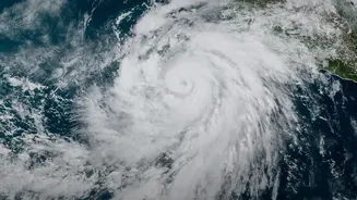
For decades, the narrative around cyclone season was dominated by numbers. How many storms will form in the Arabian Sea and the Bay of Bengal this year? What category will they be? And, most importantly, where exactly will the eye of the storm make landfall?
This focus created a sense of a high-stakes guessing game, with entire coastal districts holding their breath, waiting to see if they were in the direct path of a storm's predicted track. Media coverage amplified this, focusing on the cone of uncertainty and the moment-by-moment shifts in a cyclone's projected path. While crucial, this singular obsession with the landfall point often overshadowed other equally dangerous aspects of the storm system.
Why Counting Is Not Enough
Experience has taught us a harsh lesson: a cyclone’s most destructive power isn't always at its centre. A storm that weakens before landfall or even one that stays offshore can still be catastrophic. The problem with focusing only on the category or landfall location is that it ignores the storm's overall personality and its diverse arsenal of threats. A slow-moving, lower-intensity cyclone can dump unprecedented amounts of rain over a region for days, causing far more widespread flooding and agricultural damage than a stronger, faster-moving storm. Similarly, powerful winds and dangerous storm surges can extend hundreds of kilometres from the cyclone's eye, affecting areas that were technically not in the 'direct path'. This narrow focus could create a false sense of security for communities just outside the predicted landfall zone, leaving them dangerously unprepared.
A New Focus on Impact
Recognising these limitations, meteorological agencies, including the India Meteorological Department (IMD), are evolving their approach. The conversation is shifting from 'how many' and 'where' to 'what kind' of impacts are expected. Modern forecasting now places a greater emphasis on a wider range of variables. These include the potential storm surge height, the expected volume of rainfall over a specific period, the size of the wind field, and the areas most at risk of severe flooding, both coastal and inland. This is an 'impact-based' forecasting model. It aims to provide a more holistic picture of the threat, moving beyond the simple Saffir-Simpson or IMD intensity scale to give a more practical assessment of what the storm will actually do when it arrives.
What This Means for Coastal Communities
This shift is more than just a technical change; it's a fundamental upgrade in how we approach public safety. An impact-based warning system allows for more nuanced and targeted preparedness. For example, a fishing village might receive specific warnings about extreme storm surge, while a farming community further inland might be alerted to the threat of catastrophic rainfall and riverine flooding. This allows disaster management authorities to deploy resources more effectively. For the public, it means learning to interpret a new kind of weather report. Instead of just looking for the name of your town on a map, it means paying attention to specific warnings about wind, rain, and sea conditions, even if the storm's eye is projected to be far away. The goal is to build resilience across a wider area, not just a single point of impact.
The Challenge of Communication
This more sophisticated approach comes with its own challenge : communication . It is relatively easy to communicate the threat of a Category 5 cyclone making a direct hit . It is much harder to convey the complex , varied dangers of a large , slow - moving system that might not have a headline - grabbing intensity . Forecasters and public officials now face the task of educating the public on these new metrics . The key is to deliver clear , actionable information without causing confusion or 'warning fatigue ' . The success of this new forecasting era depends not only on the accuracy of the science but also on our collective ability to understand and act upon a more detailed and descriptive picture of the risk .