

An Unblinking Eye in a Fixed Spot
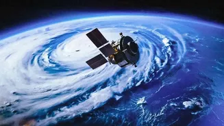
At its core, GISAT-1A is a state-of-the-art Geo-Imaging Satellite. Unlike most Earth observation satellites that orbit the planet multiple times a day in a lower orbit, GISAT-1A will be placed in a geostationary orbit roughly 36,000 kilometres above the Earth.
At this altitude, its orbital speed matches the Earth's rotation, making it appear stationary over the Indian subcontinent. This is the mission's game-changing feature. While other satellites get fleeting glimpses of a location, GISAT-1A will provide a constant, persistent watch over a huge area, like a dedicated camera on a very tall pole. This allows for near real-time monitoring, a capability India has been working to secure.
A Major Boost for National Security
One of the most significant applications of GISAT-1A lies in strengthening national security. The ability to continuously monitor a large area of interest is invaluable for strategic surveillance. Defence and security agencies can use its data to keep an eye on borders, track movements across vast and difficult terrains, and monitor maritime activity. The satellite's high temporal resolution—the ability to image a selected area every five minutes—allows for rapid observation of developing situations. While primarily a civilian satellite, this capability provides a crucial layer of intelligence for planning and operational awareness, enhancing the country's ability to preempt threats and respond effectively.
Revolutionising Disaster Management
Natural disasters in India are frequent and can evolve rapidly. GISAT-1A is poised to become a powerful tool for disaster management agencies. Cyclones, floods, and forest fires are dynamic events where conditions can change within hours. Traditional satellites might pass over the affected area only once a day, providing outdated information. GISAT-1A, however, can track the development of a cyclone, monitor the spread of floodwaters, or identify new hotspots in a forest fire in near real-time. This stream of continuous data can enable more accurate early warnings, help authorities allocate resources efficiently, and coordinate faster, more effective rescue and relief operations.
More Than Just Security and Storms
The benefits of GISAT-1A extend far beyond defence and disasters. The satellite is equipped with advanced multi-spectral and hyperspectral imaging instruments. This technology allows it to capture data across different wavelengths of light, providing detailed insights into agriculture, forestry, and environmental changes. For example, it can be used to monitor crop health and stress over large agricultural belts, assess water levels in reservoirs, track changes in forest cover, and study snow and glacier melt in the Himalayas. This data is crucial for resource management, urban planning, and long-term environmental monitoring, making GISAT-1A a versatile national asset.
A Mission of Redemption and Resilience
The September 4 launch also carries symbolic weight for ISRO. GISAT-1A, also designated EOS-05, is a replacement for its predecessor, GISAT-1 (EOS-03), which was lost in a launch failure in August 2021 due to a technical anomaly in the GSLV rocket's cryogenic upper stage. This mission is therefore not just about deploying a new satellite but also about validating the reliability of the GSLV Mk-II rocket. A successful launch will heal an old wound and restore a critical capability gap left by the 2021 failure, demonstrating the resilience of India's space program.