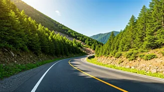


Your First Stop: Official Weather Warnings
Before you even book your trip or pack your car, your planning should start with official sources. The India Meteorological Department (IMD) is your most reliable friend. The IMD issues district-wise weather warnings, including alerts for heavy to very
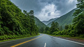
heavy rainfall, which are often precursors to landslides. Check their website for daily bulletins and colour-coded warnings (yellow, orange, red). Similarly, the National Disaster Management Authority (NDMA) provides guidelines and updates during severe weather events. Following their social media channels or checking their website can give you a high-level overview of risk areas across the country. Never dismiss an orange or red alert for a hilly region; it’s a clear signal to reconsider or delay your travel plans.
Leverage Technology for Real-Time Routes
While the idea of a single, static “safe map” is a myth during the dynamic monsoon season, technology can provide the next best thing: real-time information. Google Maps and Waze are invaluable tools, as they use live traffic data to report blockages and suggest diversions. Look for the red or dark-red lines indicating stationary traffic, which in the hills often means a roadblock. Pay attention to user-submitted reports of hazards. Many state governments, especially in high-risk areas like Uttarakhand and Himachal Pradesh, have their own disaster management apps or portals (e.g., the 'e-sarthi' portal for Himachal’s road status). Download these before you leave and check them frequently. Remember that mobile connectivity can be patchy in remote areas, so download offline maps for your entire planned route as a backup.
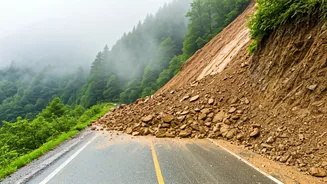
Know the Notorious Choke Points
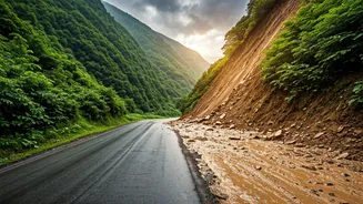
Certain national highways are notoriously prone to landslides. For instance, the Chandigarh-Manali highway (NH3), the Parwanoo-Shimla stretch (NH5), and the roads leading to Char Dham destinations in Uttarakhand frequently experience blockages. Rather than relying solely on these main arteries, research alternative routes in advance. These are often smaller state highways or local roads that run parallel or through different valleys. While they might be slower and narrower, they can sometimes remain open when major highways are shut. A good strategy is to identify potential choke points on your primary route and map out at least one or two alternative detours before you start your journey. This proactive planning can be the difference between a minor delay and being stranded for days.
Trust the Unbeatable Power of Local Intel
Technology is great, but it’s no substitute for on-the-ground human intelligence. Local residents, taxi drivers, guesthouse owners, and even the staff at a roadside dhaba possess the most current and practical information. When you stop for a break, ask about the road conditions ahead. They’ll know which small bridge was just washed away or which stretch of road has started showing signs of instability, long before it appears on any app. If a local driver advises you against taking a certain route, listen to them. They have an intimate understanding of the terrain and the behavioural patterns of their region’s monsoon. This hyper-local advice is often your best guide for making safe passage decisions.
Prepare Your Vehicle and Your Mindset
Finally, your safety depends on your preparation. Ensure your vehicle is in top condition, with special attention to tyres, brakes, and wipers. A full tank of fuel is a must, as you may face long detours or idling periods. Pack an emergency kit containing a first-aid box, extra water, non-perishable snacks, a powerful torch, a power bank for your phone, and a warm blanket. Most importantly, adopt a flexible mindset. The hills operate on their own schedule during the monsoon. Be prepared to alter your itinerary, wait out a downpour, or even turn back if the situation demands it. Your destination is not worth risking your safety. The goal is not just to reach your destination, but to do so safely.