






A Constant Watcher from Above
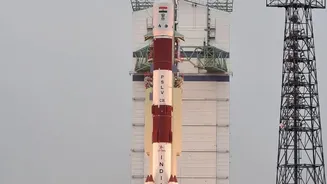
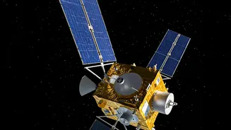
Launched aboard the GSLV-F17, EOS-05, also known as GISAT-1A, is a state-of-the-art imaging satellite with a unique advantage: its orbit. Unlike many Earth observation satellites that circle the globe in low-Earth orbit and pass over a location only at intervals,
EOS-05 is positioned in a geosynchronous orbit approximately 36,000 kilometres above the Earth. This allows it to move in sync with our planet's rotation, effectively remaining stationary over the Indian subcontinent. The result is the ability to provide near-continuous monitoring of a vast geographical area, a capability that is invaluable for a nation prone to rapidly developing natural disasters. Instead of waiting for a satellite to pass overhead, authorities can now get updates on a developing situation every 30 minutes, with the potential to focus on a specific area of interest for images as frequently as every five minutes.
Seeing Through Storms
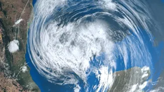
One of the most significant challenges in monitoring disasters like cyclones and floods is persistent cloud cover, which renders traditional optical satellites blind. EOS-05 is equipped with advanced multi-spectral and hyperspectral sensors that can gather data across various wavelengths of light. This allows it to see through clouds, haze, and even darkness, making it an all-weather, 24/7 observer. This is a game-changer for tracking the evolution of a cyclone in the Bay of Bengal, monitoring the spread of floodwaters during the monsoon, or detecting the early signs of forest fires in remote regions. The ability to gather data irrespective of weather conditions ensures that disaster management agencies receive a constant, uninterrupted flow of information when it is most critical.
From Flood Mapping to Landslide Alerts
The practical applications of EOS-05's imagery are vast and vital. For floods, the satellite can generate near real-time inundation maps, showing precisely which villages and infrastructure are affected. This helps authorities plan rescue operations more effectively and direct resources to the areas most in need. In the landslide-prone Himalayan regions and the Western Ghats, high-resolution imagery can help experts monitor subtle changes in the ground surface, offering potential early warnings about land subsidence or instability. Beyond these immediate crises, the satellite's data will support agricultural assessment by monitoring crop health and soil moisture, which is crucial for drought management. It will also aid in tracking forest fires and managing water resources, contributing to a more holistic approach to environmental security.
Integrating Data for On-the-Ground Action
The images from space are only one part of the equation. Their true power is realised when they are translated into actionable intelligence for agencies on the ground. ISRO works closely with the National Disaster Management Authority (NDMA) and various state disaster response forces to ensure this data reaches decision-makers swiftly. Through platforms like the Bhuvan geo-portal, processed satellite imagery is made available to state and district-level officials. This flow of information allows for better preparedness, from planning evacuation routes based on flood maps to mobilising response teams based on cyclone track predictions. EOS-05 strengthens this entire ecosystem, providing more frequent and reliable data to make India's disaster response more proactive and precise.