






The Headline Number
The IMD's forecast for the second half of the southwest monsoon season (August-September) predicts that rainfall over the country as a whole is likely to be below normal, meaning less than 94% of the Long Period Average (LPA). The LPA for August and September,
based on rainfall data from 1971 to 2020, is 422.8 mm. Similarly, the forecast for August alone also indicates below-normal rainfall. This outlook is influenced by strengthening El Niño conditions in the Pacific Ocean, which historically tend to suppress monsoon rainfall over India. While this national figure provides a broad overview, its utility for farmers, policymakers, and citizens in specific regions is limited.
A Country of Contrasts
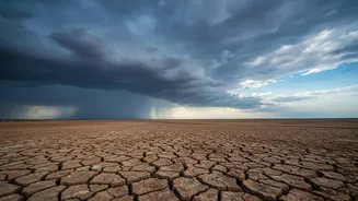
The real story of the 2026 monsoon lies in its uneven distribution. While the national average is expected to be below normal, the IMD has also indicated that some parts of Peninsular India, Central India, northern parts of Northwest India, and East and Northeast India could see normal to above-normal rainfall. This creates a scenario where some regions may face drought-like conditions while others could simultaneously grapple with floods. This spatial variation is a recurring theme; even in July, which saw a recovery in rainfall nationally, the distribution was skewed. For instance, while Central India received excess rain, many districts in other parts of the country remained deficient.
Understanding the LPA
The term 'Long Period Average' or LPA is the bedrock of monsoon forecasting in India. It is the average rainfall received over a specific region during a particular time interval, calculated over a long period, typically 30 to 50 years. The IMD currently uses the 1971-2020 period as its baseline. The LPA acts as a benchmark against which 'normal' is measured. Rainfall between 96% and 104% of the LPA is considered 'normal'. Below 90% is 'deficient', and above 110% is 'excess'. While it's a stable, scientific benchmark, the LPA is a statistical average for the entire country and doesn't capture the vast differences in rainfall from Kerala to Ladakh.
Impact on the Ground
These regional variations have profound real-world consequences. A forecast of 'below-normal' rain for the country is of little comfort to a farmer in Assam if their fields are flooded by 'above-normal' local rainfall. Conversely, a farmer in a rain-fed district of Maharashtra might face crop failure despite the national figure being only slightly below average. The outlook also projects that maximum temperatures are expected to be above normal for most of the country in August, which can further stress crops and water resources. This unevenness affects everything from agricultural output and sowing decisions to drinking water supply and the management of reservoirs.
The Challenge of a Subcontinent
Forecasting for a subcontinent is an immense challenge. The Indian monsoon is a complex system influenced by multiple global and regional factors. These include the El Niño-Southern Oscillation (ENSO) in the Pacific and the Indian Ocean Dipole (IOD). Currently, moderate El Niño conditions are prevailing and expected to strengthen. While a neutral IOD is present, some models suggest a positive IOD could develop in September, which can sometimes aid monsoon rains. This interplay of large-scale phenomena with local geography is what creates the monsoon's varied and often unpredictable character across the vast Indian landscape.