

The Grand Vision for India's Rivers
India possesses a vast network of over 14,500 km of navigable waterways, yet this mode of transport has remained highly underutilized, accounting for less than 5% of total freight movement. The government's ambitious National Waterways Act of 2016 and
the Sagarmala Programme are designed to change this. The core idea is to develop rivers like the Ganga and Brahmaputra into major arteries for cargo, shifting bulk goods like coal, cement, and food grains from strained road and rail networks. The economic argument is compelling: transporting freight by waterways is significantly cheaper and more fuel-efficient than by road or rail. A World Bank study notes the cost per ton-kilometer is ₹1.19 for waterways, compared to ₹2.28 for highways. The goal is to reduce India's overall logistics costs, which are high compared to global averages, and build a more resilient, integrated transport system.
The Ganga Model: Multi-Modal Terminals
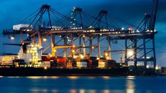
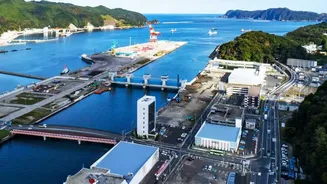
National Waterway 1 (NW-1) on the Ganga-Bhagirathi-Hooghly river system is the flagship project, stretching 1,620 km from Haldia in West Bengal to Prayagraj in Uttar Pradesh. The strategy here revolves around large Multi-Modal Terminals (MMTs) at key locations like Varanasi, Sahibganj, and Haldia. These terminals are not just ports; they are sophisticated logistics hubs designed to integrate river transport with road and rail. Cargo arrives on large vessels and is then transferred to trucks or trains for its final journey inland. For example, the terminal at Varanasi has the capacity to handle over a million metric tons per year and provides a direct link to the major ports of Kolkata and Haldia. This model is ideal for industrial heartlands where established road and rail infrastructure can connect seamlessly with the river, creating an efficient chain for high-volume goods.
The Brahmaputra Lifeline: Ro-Ro Ferries and Jetties
In the Northeast, the approach on National Waterway 2 (NW-2), the 891 km stretch of the Brahmaputra in Assam, is different. Here, the terrain is more challenging and road connectivity can be sparse. Instead of relying solely on large MMTs, the focus is on flexibility. Roll-on/Roll-off (Ro-Ro) ferry services have become a critical component, allowing entire trucks to be driven onto a vessel, transported across the river, and driven off at the other end. This bypasses congested bridges and poor road sections, dramatically cutting travel time and cost. The Ghogha-Hazira Ro-Pax ferry service, for instance, reduced a 10-hour road journey to just 4 hours by sea. Alongside these, a network of smaller, floating community jetties is being built to connect remote communities and agricultural producers directly to the waterway, solving the last-mile problem at a more local level.
Waterways vs. Roads: The Real-World Trade-Offs
The primary advantage of waterways is cost and environmental impact. One litre of fuel can move 215 tonne-kilometres on a waterway, compared to just 24 on the road. For businesses moving bulk, non-perishable goods, the savings can be substantial. However, speed and flexibility remain the domain of road transport. Water transport is inherently slower, and its reach is limited to the river's path. The success of waterways is therefore entirely dependent on the quality of the last-mile connections. A recent government statement acknowledged that a key challenge is still "inadequate first and last-mile connectivity" and a lack of multimodal infrastructure in some areas. Furthermore, inland waterways face their own challenges, including seasonal variations in water depth, the need for continuous dredging to keep channels clear, and the high initial investment in modern vessels and terminal infrastructure.