







The View From Above: What Satellites Show
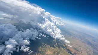
Recent satellite images from the India Meteorological Department (IMD) and other weather agencies reveal a distinct change in the atmospheric landscape over the subcontinent. What was once a thick blanket of moisture-laden clouds across northwestern India is now
beginning to break apart. Water vapour imagery shows a considerable reduction in moisture over western parts of Rajasthan and neighbouring areas. Visually, this translates to clearer skies and more visible landmass, a stark contrast to the cloud-filled images typical of peak monsoon. This drying pattern is the first and most crucial visual confirmation that the monsoon's powerful engine is starting to wind down in the region, paving the way for its slow, phased exit.
The Science of the Great Withdrawal
The monsoon doesn't just stop; it is pushed out by a series of meteorological changes. The IMD declares the start of the withdrawal only when specific criteria are met consistently for five days. Firstly, rainfall must cease over the region. Secondly, and most importantly, an anti-cyclonic circulation needs to establish itself in the lower atmosphere, around 1.5 km above the surface. This high-pressure system reverses the moisture-carrying southwesterly winds, replacing them with drier northwesterly winds. The final piece of evidence is the sharp drop in atmospheric moisture, which is precisely what the latest satellite pictures are confirming. This combination signals a fundamental shift from a wet to a dry weather regime.
A Journey Across the Subcontinent
The monsoon's retreat is a gradual, cross-country journey, not an overnight event. It always begins from the extreme northwestern parts of India, typically around west Rajasthan, on or after September 1st. From this starting point, the withdrawal line slowly moves southeastward. It can take about two weeks to leave northern India and another month or so to retreat from the central and peninsular regions. By mid-October, it has usually withdrawn from the entire country north of the southern peninsula. The complete withdrawal from the southernmost tip of India often doesn't happen until early December. This staggered process means that while Rajasthan is experiencing post-monsoon dry weather, states in the south and east might still be receiving heavy rainfall.
What the Retreat Means for Weather and Agriculture
The withdrawal of the southwest monsoon brings significant changes. For the northern and central plains, it ushers in a period of clearer skies, lower humidity, and more pleasant temperatures. However, this period is also critical for agriculture. The residual moisture in the soil after the monsoon's departure is vital for the sowing of winter (Rabi) crops like wheat, mustard, and chickpeas. A timely and orderly withdrawal provides the ideal conditions for a successful planting season. On the other hand, the retreating monsoon isn't entirely benign. As it passes over the warm waters of the Bay of Bengal, it can pick up moisture again, leading to the northeast monsoon that brings significant rainfall to Tamil Nadu, parts of Andhra Pradesh, and Kerala in October and November. This period is also the primary season for the formation of intense tropical cyclones in the Bay of Bengal.