







Beyond the Default Route
When you plug a destination into your standard GPS app, its main goal is to find the fastest or shortest path. In ideal conditions, this is perfect. But winter adds dangerous variables that these simple algorithms might not prioritise. The quickest route
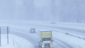
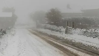
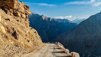
could lead you over a high-elevation mountain pass where temperatures are significantly lower, increasing the risk of black ice and sudden snowstorms. These passes often feature steep grades, sharp curves, and limited guardrails, all of which become treacherous when frozen. The shadows cast by mountains can also keep sections of the road icy long after others have cleared. A few extra minutes on a longer, lower-elevation route can mean the difference between a smooth journey and a roadside emergency. True winter preparation means looking beyond the default blue line on the map and considering the terrain your route will cover.
Harnessing Real-Time Data
Modern navigation apps like Google Maps and Waze are much more than static maps; they are dynamic systems that use real-time, crowdsourced data to reflect current conditions. Every user with their location services enabled acts as a traffic sensor, feeding anonymous data about their speed back to the system. When many cars in one area suddenly slow down, the app identifies a potential traffic jam. Crucially, users can also actively report hazards like accidents, stalled vehicles, or weather-related dangers. This combination of automated data and human reporting allows these apps to show road closures and offer alternative routes almost instantly. Before and during your trip, keep a close eye on your navigation app for red lines indicating closures or heavy traffic, and always accept rerouting suggestions that guide you away from reported hazards.
The Undisputed Authority: Official Sources
While consumer apps are incredibly useful, the ultimate ground truth for road conditions comes from official government sources. In the US, most state Departments of Transportation (DOT) operate robust traveler information websites and phone services, often under the '511' banner. These services provide the most accurate and reliable information because it comes directly from road crews and highway patrol officers on the ground. Many DOT websites feature live camera feeds, detailed reports on whether a road is dry, wet, or snow-packed, and definitive closure announcements. Some states, like Colorado and Oregon, have dedicated sites like TripCheck.com that are essential for mountain travel. Before heading into the mountains, cross-referencing your app-based route with the official DOT report for that region is a non-negotiable safety step.
Technology Is a Co-Pilot, Not the Pilot
Route planning technology is a powerful co-pilot, but you are still the one in charge of the vehicle. Never rely on a GPS device blindly, as it may not recognise which smaller forest roads are unmaintained and unplowed in winter. Your planning should begin long before you get in the car. Check detailed weather forecasts specifically for the mountain passes on your route, not just your origin and destination. Always have a backup plan, including an alternative route or even a place to stay overnight if conditions become too hazardous. The most important decision a driver can make is knowing when not to go. If forecasts look severe or authorities are advising against travel, it's always wisest to delay your trip. No destination is worth risking your safety.
Your Pre-Departure Safety Checklist
A safe journey begins at home. Before any winter mountain trip, run through this simple checklist. First, ensure your vehicle is winter-ready with proper tyres, a healthy battery, and topped-up fluids. Second, pack a winter emergency kit in your car. This should include blankets, extra warm clothing, food, water, a first-aid kit, and a phone charger. Third, always start your trip with a full tank of fuel; you burn more fuel at slower speeds and may need to keep the engine running for heat if you get stuck. Finally, tell someone your planned route and estimated arrival time. Check your primary route and official road reports the night before, the morning of, and one last time right before you leave. Conditions in the mountains can and do change that quickly.