



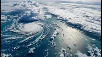




Our Eyes in the Sky
The days of relying solely on ground-based observations and delayed data from foreign agencies are long gone. Today, India has its own sophisticated network of meteorological satellites operating in geostationary orbit, about 36,000 kilometres above the
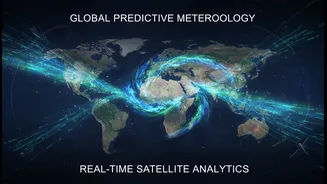
equator. The workhorses of this fleet are the INSAT series, specifically INSAT-3D and INSAT-3DR, which serve as dedicated weather observatories. These satellites, along with others like the Oceansat series, provide a continuous stream of data that is indispensable for the India Meteorological Department (IMD) to monitor the vast and dynamic weather systems influencing the subcontinent. This indigenous capability allows scientists to watch the monsoon evolve in real-time, a critical advantage for a country whose fortunes are so closely tied to the seasonal rains.
More Than Just a Picture
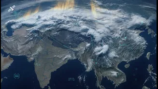
The images from ISRO's satellites are far more than simple photographs of clouds. They are rich, multi-layered data sets. The INSAT-3DR, for instance, is equipped with a six-channel imager that captures imagery across different spectrums, including visible light, shortwave infrared, and thermal infrared. This allows meteorologists to not just see the clouds, but to understand them. The bright white appearance of cloud tops in infrared imagery indicates they are extremely cold, a sign of deep convection and powerful thunderstorms capable of producing very heavy rain. By tracking cloud movements, temperature, and height, forecasters can determine the intensity and direction of weather systems. Furthermore, a 19-channel sounder instrument slices vertically through the atmosphere, measuring temperature and humidity at various altitudes, giving a complete three-dimensional profile of the atmospheric conditions driving the monsoon.
Decoding the Ocean's Influence
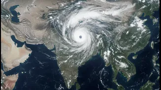
The monsoon is not just an atmospheric event; it is deeply connected to the ocean. Satellites play a crucial role in monitoring the key oceanic parameters that fuel the monsoon's engine. One of the most important factors is Sea Surface Temperature (SST). Satellites like the Oceansat series and the imagers on INSAT constantly measure the temperature of the Indian Ocean and the Bay of Bengal. Warmer sea surfaces lead to greater evaporation, feeding more moisture into the atmosphere. This moisture-laden air is then carried over the Indian landmass by monsoon winds. Recent satellite images have clearly shown weather systems over the Arabian Sea intensifying as they feed on warm SSTs, leading to heavy rainfall along the western coast. This ability to monitor the ocean-atmosphere interaction is fundamental to predicting the monsoon's strength and progress.
From Data to Daily Forecasts
Raw satellite data, while valuable, needs to be translated into actionable forecasts. This is where a powerful synergy between ISRO and the IMD comes into play. A continuous stream of data from the INSAT satellites is beamed down to ground stations and processed by the INSAT Meteorological Data Processing System (IMDPS). This information—on cloud motion, wind vectors, humidity, and temperature—is then fed into sophisticated numerical weather prediction models. In fact, over 90% of the data used in these models is now satellite-based. The assimilation of this high-quality, high-frequency data has significantly improved the accuracy of short to medium-range forecasting, with the IMD reporting an improvement of about 20% to 30%. This leads to more reliable daily weather updates and more precise warnings for severe weather events like cyclones and heavy rainfall spells.
Safeguarding Lives and Livelihoods
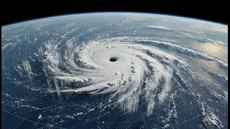
The practical impact of this enhanced understanding is profound. For a nation where agriculture is heavily dependent on rainfall, accurate monsoon forecasting is vital. Knowing the onset timing and expected intensity allows farmers to better plan their planting schedules. Beyond agriculture, the data is critical for disaster management. Early warnings for cyclones, derived from tracking low-pressure systems over the ocean, save countless lives by allowing for timely evacuations. Real-time flood early warning systems and even landslide prediction models use satellite-derived rainfall data to assess risks. The clarity provided by these eyes in the sky helps authorities manage water resources, prepare for extreme weather, and build a more resilient nation in the face of a changing climate.