








What is an Integrated Satellite System?
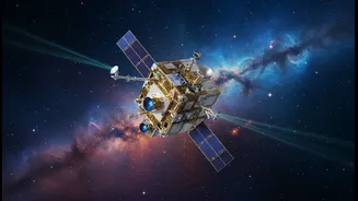
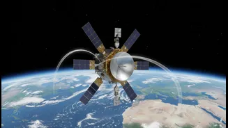
While you may not have heard of a specific system called 'GRITSS', the name represents a powerful concept: an integrated satellite system that combines multiple space-based capabilities into a single, cohesive framework. Think of it less as a single satellite and
more as a 'system of systems'. In India's context, this involves harnessing the distinct strengths of its existing satellite programs. For instance, it would conceptually merge the positioning capabilities of NavIC, the high-resolution earth observation of the Cartosat series, and the meteorological prowess of the INSAT satellites. The goal of such an integrated approach is to create a versatile and powerful tool that serves a wide array of functions, from guiding vehicles and ships to monitoring crop health and predicting cyclones, all under a sovereign national infrastructure.
Powering Precise Navigation
At the heart of any modern integrated system is navigation. For India, this capability is provided by NavIC (Navigation with Indian Constellation), the country's autonomous regional navigation system. Like the American GPS, NavIC uses a constellation of satellites orbiting the Earth. These satellites, equipped with highly precise atomic clocks, continuously broadcast time signals. A receiver on the ground—in your phone, car, or a ship's console—picks up signals from at least four of these satellites. By calculating the tiny differences in the time it takes for each signal to arrive, the receiver can pinpoint its exact location through a process called trilateration. A system like GRITSS would leverage this to provide real-time positioning for everything from civilian transport and vehicle tracking to disaster management and guiding military assets, ensuring India does not have to depend on foreign systems.
High-Resolution Mapping from Above
The mapping component of an integrated system relies on remote sensing satellites. India's Cartosat series of Earth observation satellites are masters of this domain. These satellites are essentially powerful cameras in orbit, capturing highly detailed images of the Earth's surface. Some, like Cartosat-3, can see objects as small as 25 centimetres, providing incredible detail for cartography. These images are crucial for urban and rural planning, monitoring infrastructure development, managing natural resources, and supporting military surveillance. An integrated system would use this data to create detailed, up-to-date maps for everything from managing road networks and water distribution to planning new smart cities and monitoring changes in land use over time.
Monitoring Our Climate and Weather
The third pillar is climate and weather measurement, a role fulfilled in India by the INSAT (Indian National Satellite System) series. Satellites like INSAT-3D and INSAT-3DR are designed specifically for enhanced meteorological observations. They carry instruments called sounders and imagers that can generate vertical profiles of the atmosphere, measuring temperature and humidity. They monitor cloud patterns, sea surface temperatures, and snow cover, providing crucial data for weather forecasting. This capability is vital for predicting monsoons, tracking the formation and path of cyclones, and issuing timely warnings for disaster management. An integrated system ensures this climate data can be combined with mapping and navigation information for more effective response during natural calamities.
The Key Benefits
The primary benefit of a sovereign, integrated satellite system is strategic autonomy. It reduces a nation's dependence on foreign-operated systems like GPS, which could be denied or degraded during geopolitical conflicts. This self-reliance is critical for national security. Secondly, it drives economic growth by enabling a host of applications in logistics, precision agriculture, fisheries, and transportation. Thirdly, it vastly improves disaster management capabilities by providing accurate data for early warnings and coordinating relief efforts. Finally, developing and maintaining such a complex system fosters a domestic ecosystem of high-tech jobs, research, and innovation, solidifying India's position as a major space power.
Understanding the Limits
Despite the immense benefits, there are significant limitations. The foremost is the colossal cost. Designing, building, launching, and maintaining a constellation of satellites and the required ground infrastructure demands massive, long-term investment. These space assets are also vulnerable. Satellites have finite lifespans, can suffer technical failures like failing atomic clocks, and are susceptible to damage from space debris or even deliberate anti-satellite actions. Furthermore, ensuring widespread adoption among civilians requires the industry to produce affordable, compatible receivers for everything from smartphones to tracking devices, a challenge that can slow down integration into daily life. Lastly, the pace of technological change means that any system requires continuous upgrades to remain effective.