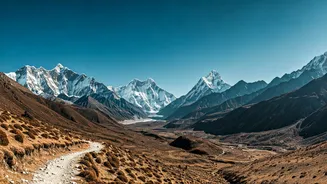


The Challenge of the Unmarked Trail
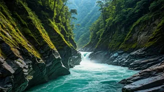
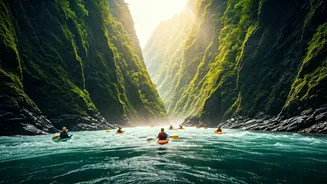
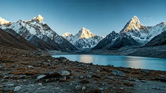
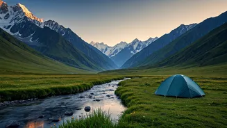
Venturing into the remote corners of Arunachal Pradesh is an adventurer’s dream. From the rhododendron forests of Tawang to the hidden valleys of Mechuka, the landscapes are breathtakingly raw. However, this raw beauty is what makes navigation so difficult.
Many trails are not officially marked, mobile networks can be non-existent for days, and weather conditions can change in an instant, turning a clear path into a confusing maze. Traditional maps often lack the detail needed for trekking, and even seasoned travellers can find themselves disoriented. This is where the concept of 'shared navigation' transforms from a tech novelty into an essential safety tool. It’s about creating a digital breadcrumb trail that not only guides you but also allows others to know where you are, providing a crucial safety net in a region where you can truly be on your own.
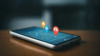
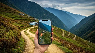
What Exactly Is Shared Navigation?
Shared navigation isn’t a single app or device. It’s a method of using technology to make your journey transparent to a trusted contact back home or to your travel group. At its simplest, it involves sharing your live location. In more advanced forms, it means sharing a pre-planned route (a GPX file) with your guide or friends, so they know your intended path. During your trek, you can then share your real-time progress against that planned route. This serves two purposes. First, it helps you stay on track. Second, and more importantly, if you deviate from the path or stop moving for an unusual amount of time, your designated contact can raise an alert. It’s a modern evolution of the age-old practice of telling someone where you’re going and when you expect to be back, but with the precision of GPS technology.
Essential Tools for Your Kit
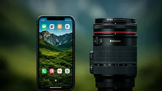
To implement shared navigation, you need the right tools. Your smartphone is the starting point, but you'll need specific apps and possibly hardware depending on the remoteness of your trip.
1. **Google Maps Location Sharing:** In areas with intermittent connectivity, this is a simple and free option. You can share your live location for a specific duration with a trusted contact. It’s best for drives between towns or short hikes near populated areas.
2. **Dedicated Trekking Apps (AllTrails, Gaia GPS, Komoot):** These are the workhorses for serious trekkers. They allow you to download offline maps, so you can navigate without a mobile signal. You can import GPX files of established routes (often shared by other trekkers) and many have a feature to share your live location or 'beacon' when you do get a signal.
3. **Satellite Messengers (Garmin inReach, ZOLEO):** For true off-grid exploration deep in the mountains, a satellite messenger is a non-negotiable investment. These devices work anywhere on Earth. They let you send pre-set or custom text messages, share your GPS coordinates, and have an SOS button that connects you directly to emergency response services. This is the ultimate safety net.
Setting Up Your Digital Safety Net
Before you leave, set up your system. First, choose your primary tool based on your itinerary. Download the necessary offline maps for the entire region you plan to cover. Second, have a conversation with your designated safety contact. Explain how the system works, what app you're using, and establish a check-in schedule. Agree on a protocol: for example, if you are stationary for more than two hours during planned trekking times or deviate more than a kilometre from the route, they should try to contact you, and if they can't, they should alert local authorities or your tour operator. Share the pre-planned route with them. Finally, test the system before you enter a no-network zone to ensure everything is working correctly. A well-charged power bank is just as important as the device itself.
Technology Is a Partner, Not a Replacement
While these tools are incredibly powerful, they are not a substitute for local knowledge and common sense. The most important safety asset you can have in Arunachal Pradesh is a registered, experienced local guide. They understand the terrain, the weather patterns, and the culture in a way no app can. They know the alternate routes if a path is blocked by a landslide and can communicate with villagers in local dialects. Use technology as a supplement to their expertise, not a replacement. Share your digital route with your guide so you are both on the same page. This combination of modern tech and traditional wisdom creates the most robust safety system possible, allowing you to immerse yourself in the experience with peace of mind.