







ISRO’s Watchful Guardians Above
For decades, the Indian Space Research Organisation (ISRO) has been developing a fleet of Earth observation satellites, and the OceanSat series is a jewel in that crown. Launched to provide continuous and detailed data about our oceans, these satellites are
multi-purpose platforms designed for oceanography and atmospheric studies. The latest in this series, EOS-06, also known as OceanSat-3, was launched in November 2022 and represents a significant leap in capability. Orbiting the Earth in a polar sun-synchronous orbit, it circles the globe at an altitude of about 740 kilometres, ensuring that it can systematically cover the planet's oceans every two days. This continuity is vital, allowing scientists to build long-term climate records and provide timely information for daily applications. The satellite carries a suite of advanced sensors, each with a specific job, working in concert to paint a comprehensive picture of the ocean's health and behaviour.
Painting a Picture of Ocean Life
One of the key instruments aboard OceanSat-3 is the Ocean Colour Monitor (OCM-3). This isn't just a simple camera; it's a sophisticated sensor that measures the colour of the ocean across 13 different spectral bands. But why is ocean colour so important? The colour of seawater is determined by what’s in it. Specifically, the OCM is tuned to detect the presence of chlorophyll, the green pigment in phytoplankton. These microscopic marine plants are the foundation of the entire oceanic food web. By mapping chlorophyll concentrations, scientists can identify areas of high biological productivity. This data is invaluable for locating Potential Fishing Zones (PFZ), which are advisories sent to fishermen to help them find abundant catches more efficiently, saving fuel and time. Beyond fishing, the OCM helps monitor harmful algal blooms, tracks sediment flow from rivers, and provides crucial insights into the ocean's role in the global carbon cycle.
Decoding the Weather Over Water
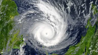
While the OCM looks at the life within the ocean, another critical instrument tracks the forces acting upon it: the weather. This is the job of the Ku-Band Scatterometer (SCAT-3). A scatterometer is an active microwave radar that sends pulses of energy down to the ocean surface and measures the signals that bounce back. A calm, smooth sea will reflect the signal differently than a rough, choppy one. By analysing this backscatter from multiple angles, the scatterometer can accurately determine both wind speed and direction over the ocean. This information is absolutely critical for weather forecasting, especially for detecting the formation and intensification of cyclones. With very few weather buoys in the open ocean, scatterometers provide the most comprehensive data on surface wind fields, allowing meteorologists to issue timely warnings and predict a cyclone's track with greater accuracy.
From Data to Daily Life
The data from OceanSat’s instruments doesn't just stay in a lab; it has a profound impact on the ground and along the coast. The wind data from the scatterometer and sea surface temperature readings are fed directly into weather models used for cyclone prediction, helping disaster management agencies plan for evacuations and save lives. The Potential Fishing Zone advisories, derived from OCM data, are a cornerstone of marine resource management, directly boosting the economic well-being of coastal fishing communities. Furthermore, the long-term, consistent data gathered by the OceanSat series helps scientists monitor the effects of climate change, such as the warming of sea surfaces and changes in polar ice. This synergy of instruments, where wind data helps explain chlorophyll distribution and temperature affects weather patterns, makes OceanSat a powerful, integrated tool for science and society.