





A Groundbreaking Partnership in Orbit
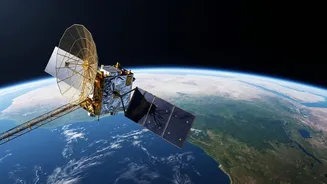
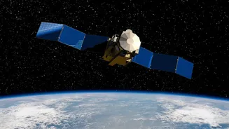
NISAR, which stands for NASA-ISRO Synthetic Aperture Radar, is a joint Earth-observation mission between the American and Indian space agencies. Launched in mid-2025, this sophisticated satellite is one of the most ambitious and expensive Earth-imaging
projects ever undertaken. Its primary goal is to make global measurements of changes on the planet's surface, from the shifting of ice sheets to the subtle movements that precede earthquakes. For India, the mission holds particular promise. ISRO contributed a key component, the S-band radar, and shares ownership of the data, which is now being streamed to receiving stations like the one at Bhoonidhi. This collaboration places India at the forefront of advanced Earth observation.
The Power of Seeing Through Clouds
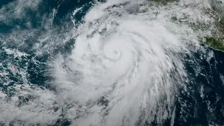
Unlike traditional optical satellites that are essentially cameras in space, NISAR uses Synthetic Aperture Radar (SAR). This technology is an active sensor, meaning it sends out its own microwave pulses and reads the echoes that bounce back. This gives it two huge advantages. First, it can see day or night. Second, and more importantly for a country like India, its radar waves can penetrate clouds, smoke, and haze. During the monsoon season, when vast swathes of the country are obscured by cloud cover for months, optical satellites are effectively blind. NISAR, however, continues to map the ground without interruption, providing a consistent stream of data every 12 days. This all-weather capability is a fundamental leap forward for continuous environmental monitoring.
A Dual-Blade Approach to Forest Mapping
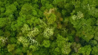
What makes NISAR truly unique is that it is the first satellite to use two different radar frequencies together: the NASA-developed L-band and the ISRO-developed S-band. Think of it as having two different types of vision. The longer wavelength L-band radar can penetrate deeper into the forest canopy, providing information about the larger branches and trunks of trees. This is crucial for accurately estimating forest biomass—the total amount of organic matter—which is a key metric for understanding carbon storage and the impact of deforestation. The shorter wavelength S-band radar is more sensitive to the leaves and smaller branches in the upper canopy. By combining data from both radars, scientists can build a detailed, three-dimensional picture of forest structure that was previously impossible to obtain from space on such a large scale.
What This Means for India's Forests
The high-precision data from NISAR is set to revolutionize forest management in India. It will allow for much more accurate tracking of deforestation and forest degradation, even detecting subtle changes that were previously missed. Authorities can now monitor the health of forests, track the impact of forest fires with greater accuracy, and better manage vital ecosystems like mangroves. For example, a pilot study at the Jhilmil Jheel wetland in Uttarakhand demonstrated NISAR's ability to map water-logged surfaces hidden beneath dense forest canopies, a vital capability for wetland management. This level of detail helps in everything from deploying resources to fight illegal logging to developing more effective conservation strategies and meeting national climate goals by providing a more accurate carbon stock inventory.
Beyond the Forest Canopy
While its impact on forestry is immense, NISAR's mission extends far beyond the trees. The same data is invaluable for a host of other applications relevant to India. It can monitor agricultural lands to assess crop health and soil moisture, providing insights for food security. Its ability to detect ground deformation down to a centimetre makes it a powerful tool for monitoring landslides in the Himalayas, land subsidence in urban areas, and the dynamics of glaciers. After a full year of operations, the satellite is providing a steady stream of data for disaster management, helping to assess the impact of floods and earthquakes, and contributing to a deeper scientific understanding of our dynamic planet.