






An Eye on the Storms
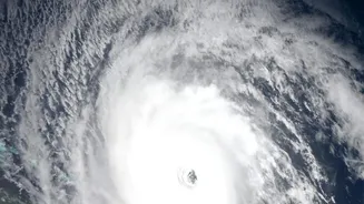
For a country with a vast coastline, cyclone monitoring is a critical priority. India's meteorological satellites, particularly the INSAT series (like INSAT-3D and INSAT-3DR), are the frontline defence. These geostationary sentinels continuously watch
over the Indian Ocean, tracking the formation of low-pressure areas that can intensify into cyclones. They are equipped with advanced imagers and sounders that provide real-time data on cloud patterns, wind speed, and sea surface temperature, all crucial variables for predicting a cyclone's path and intensity. This constant stream of information allows the India Meteorological Department (IMD) to issue timely and accurate warnings, giving authorities precious hours and days to carry out evacuations and secure infrastructure, drastically reducing the potential loss of life.
Mapping the Deluge
Floods are one of India's most frequent and devastating natural disasters. Satellite data provides an unparalleled advantage in both prediction and response. Before a flood, satellite imagery helps create detailed topographical maps and identify flood-prone zones. During a monsoon or extreme rainfall event, satellites equipped with Synthetic Aperture Radar (SAR), like those in the RISAT series, have a unique capability: they can see through dense cloud cover. This allows agencies like the National Remote Sensing Centre (NRSC) to generate near real-time inundation maps, showing exactly which areas are underwater. These maps are disseminated through portals like Bhuvan and provided to disaster management authorities, guiding rescue teams on the ground to where they are needed most and helping to assess the scale of the damage for effective relief efforts.
A Friend to the Farmer
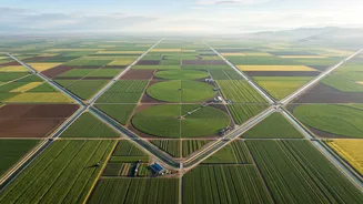
Beyond disasters, satellite data is transforming Indian agriculture. With millions of smallholder farmers, this technology offers a way to provide field-specific intelligence at a massive scale. Earth observation satellites monitor crop health by analysing vegetation indices, which can reveal stress from pests, diseases, or lack of water long before it's visible to the naked eye. This data is also crucial for estimating soil moisture levels, which helps in managing irrigation and predicting agricultural drought. Government programmes like FASAL use this information to generate pre-harvest production estimates for major crops, aiding policy decisions. Furthermore, satellite data is being integrated into crop insurance schemes like the Pradhan Mantri Fasal Bima Yojana (PMFBY) to verify claims and assess yield more accurately, making the system more transparent and efficient for farmers.
The Technology Behind the Data
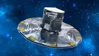
The engine behind this support system is the Indian Space Research Organisation (ISRO). ISRO not only builds and launches these sophisticated satellites but also manages the vast infrastructure for data processing and distribution. Through platforms like the Bhuvan geoportal and the National Database for Emergency Management (NDEM), this complex information is made accessible and actionable for various government agencies. These platforms integrate satellite data with other information sources, creating a comprehensive picture that supports everything from disaster response coordination to long-term planning for climate resilience. By continuously upgrading its satellite fleet with enhanced sensors and capabilities, ISRO ensures that India's ability to monitor its land, oceans, and atmosphere keeps improving.