






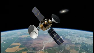


A New Definition of Space Diplomacy
Traditionally, space diplomacy involved treaties and prestige projects among global powers. Today, India is reshaping this concept into something far more practical: 'development diplomacy'. Instead of just collaborating with other space-faring nations,
India is positioning itself as a partner to the Global South. Through ISRO, it offers satellite launches, training, and, most importantly, data sharing to developing countries that lack these capabilities. This strategy was born partly out of necessity after India faced technology denial regimes in its early days, pushing it towards self-reliance. Now, that hard-won expertise is a tool for building goodwill and projecting a new kind of smart power, one based on generosity and shared problem-solving.
The Global First Responder
One of the most powerful applications of this new diplomacy is disaster management. India is prone to natural calamities, and ISRO has developed a sophisticated system of satellites to monitor floods, cyclones, landslides, and forest fires in near real-time. Through geoportals like Bhuvan and the National Database for Emergency Management (NDEM), this crucial information is disseminated to authorities to save lives. But this support extends far beyond India's borders. As a founder and active member of the International Charter 'Space & Major Disasters', ISRO provides satellite data to countries worldwide during emergencies. In 2025, ISRO took on a six-month lead role in coordinating the Charter's global disaster response efforts. This transforms satellite imagery from a strategic asset into a humanitarian tool, helping countries from Southeast Asia to the Pacific manage crises.
An Eye on a Changing Planet
Alongside immediate disasters, India's satellites are playing a vital role in monitoring the slow-burn crisis of climate change. A fleet of Earth observation satellites, including the INSAT and Oceansat series, continuously tracks key indicators like rising sea levels, rainfall patterns, and sea surface temperatures. This data is crucial for understanding the retreat of Himalayan glaciers, a direct threat to water security in the region. The commitment to climate monitoring is also a cornerstone of international collaboration. The NASA-ISRO Synthetic Aperture Radar (NISAR) mission, a landmark partnership with the US, is the world's most expensive Earth-imaging satellite. Launched in 2025, NISAR maps the entire globe every 12 days with unprecedented accuracy, tracking changes in ecosystems, ice sheets, and groundwater with the goal of providing its data freely to the global scientific community.
Bengaluru: The Ecosystem's Engine
While ISRO leads these initiatives, the engine room for this data-driven revolution is Bengaluru. The city is more than just the home of ISRO's headquarters; it's a thriving ecosystem for space-tech startups. With the government liberalising foreign direct investment and providing funding through schemes like the Technology Adoption Fund (TAF), private companies are flourishing. These startups aren't just building rockets. Many, like SatSure Analytics and GalaxEye Space, focus on the critical downstream work of interpreting satellite data. They develop AI-powered platforms to generate actionable insights for agriculture, infrastructure monitoring, and disaster management, turning raw data from space into practical solutions on the ground. This private-sector dynamism is what makes India’s space diplomacy sustainable and scalable.