







Meet India's New Guardian
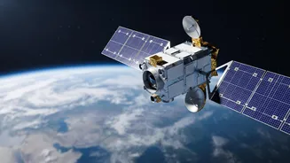
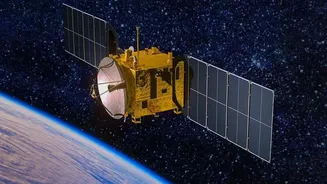
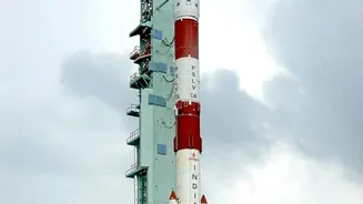
Dubbed EOS-05, this advanced Earth observation satellite represents a major leap for India's strategic capabilities. Launched aboard the powerful GSLV-F17 rocket from Sriharikota, it is not just another satellite; it's the country's first imaging satellite placed
in a geostationary orbit. This mission is especially significant as it is the successor to the GISAT-1 (also known as EOS-03), which was lost during a launch failure in 2021. The successful deployment of EOS-05 marks a moment of triumph and resilience for ISRO, restoring and strengthening a critical national security asset. Weighing over 2,200 kg, the satellite is designed for a service life of seven years, providing a long-term watch over the Indian subcontinent.
The Magic of 36,000 Kilometres
The satellite's orbit, approximately 36,000 km above the equator, is its defining feature. At this specific altitude, a satellite enters a geostationary orbit, meaning its orbital period matches Earth's 24-hour rotation. To an observer on the ground, the satellite appears to be stationary, hovering over the same spot continuously. This is a game-changer compared to most other Earth observation satellites, which operate in Low Earth Orbit (LEO) at altitudes of a few hundred kilometres. LEO satellites orbit the Earth rapidly and can only view a specific location for a brief period as they pass overhead. In contrast, EOS-05's fixed gaze allows for persistent, 24/7 monitoring of a large, designated area, which is invaluable for national security.
A Powerful, Unblinking Eye
So, what can this new satellite actually see? EOS-05 is equipped with high-resolution imaging instruments, including multi-spectral and hyper-spectral cameras that can capture images in various bands of light, including visible, near-infrared, and short-wave infrared. This allows it to see far more than the human eye. The satellite can provide images of the entire Indian landmass roughly every 30 minutes, and for specific areas of interest, it can deliver updates as frequently as every five minutes. This near-real-time capability is crucial for tracking fast-moving developments, such as troop movements along sensitive borders, monitoring infrastructure build-up in remote areas, and assessing natural disasters as they unfold. Its advanced sensors can provide round-the-clock imaging, a vital capability for modern surveillance.
More Than Just Border Security
While its strategic importance for border surveillance is paramount, the applications of EOS-05 extend far beyond defence. The ability to provide frequent and wide-area imaging makes it a powerful tool for disaster management. It can help agencies monitor the development of cyclones, track the spread of forest fires, and assess the extent of flooding, enabling faster and more effective response efforts. Furthermore, the satellite will provide crucial data for agriculture, helping to monitor crop health and assess land use patterns. It can also aid in monitoring environmental changes, from forestry to water resources, making it a dual-use technology that serves both civilian and military needs.
A Strategic Leap for India
The launch of EOS-05 is a significant milestone in India's journey towards self-reliance in space technology and defence. Having a sovereign capability for continuous surveillance reduces reliance on foreign intelligence and provides a decisive strategic advantage in the region. This satellite joins a growing constellation of Indian spacecraft dedicated to national security, which includes the RISAT series for all-weather radar imaging and the Cartosat series for high-resolution mapping. With this new 'eye in the sky', India can autonomously monitor its land and maritime borders, track assets, and maintain a constant vigil over areas of interest, reinforcing its position as a major space-faring nation with robust defence capabilities.