






A Constant Watcher in the Sky
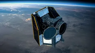
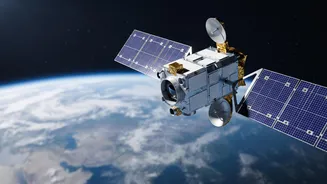
Most Earth observation satellites operate in a Low Earth Orbit (LEO), circling the planet from pole to pole. While powerful, they can only view a specific location when they pass over it. In contrast, EOS-05 is a geosynchronous satellite. It will be placed
in a high orbit approximately 36,000 kilometres above the equator, moving at the same speed as the Earth's rotation. This allows it to remain effectively stationary over a single large area, providing continuous, near real-time imagery of the Indian subcontinent. Think of it as the difference between a security guard doing occasional rounds and a fixed CCTV camera providing a constant feed. This persistent monitoring capability is what makes this class of satellite a strategic game-changer.
Revolutionising Disaster Management
For a country prone to natural disasters, the ability to monitor developing situations is critical. A geosynchronous imager can track the formation and movement of cyclones, the spread of forest fires, and the development of floods in near real-time. Reports indicate that EOS-05 will be able to scan the entire Indian landmass every 30 minutes and revisit priority areas as frequently as every five minutes. This rapid revisit capability means that disaster management agencies can receive a constant stream of updated information, enabling faster and more accurate warnings, better resource allocation for evacuation and relief efforts, and a more comprehensive understanding of a disaster's impact as it unfolds.
A Boost for Agriculture and Environment
Beyond emergencies, continuous observation offers immense benefits for India's agricultural sector and environmental monitoring. The satellite's instruments can provide data on crop health, soil moisture levels, and vegetation cover across vast areas. This information is invaluable for forecasting yields, managing water resources, and providing farmers with crucial advisories. Furthermore, such a satellite can monitor glaciers, water bodies, and forest cover, offering vital data for climate change studies and resource management. Its ability to see through cloud cover more effectively than lower-orbit satellites, due to its ability to take multiple images of the same area, is particularly useful in tropical regions.
Enhancing National Security
The strategic importance of a persistent 'eye in the sky' cannot be overstated. While primarily a civilian satellite, the capabilities of EOS-05 have significant dual-use applications. The ability to continuously monitor borders and vast maritime areas provides a distinct advantage for national security. It allows for the tracking of movements in sensitive areas without the predictable gaps of polar-orbiting satellites, offering a new layer of surveillance and operational planning support for defence forces. This makes the satellite a crucial asset for maintaining vigilance over regions of interest.
The Road to a New Vision
The launch of EOS-05, also known as GISAT-1A, is a high-stakes mission for the Indian Space Research Organisation (ISRO). It serves as the successor to the nearly identical EOS-03 satellite, which was lost in a launch failure in August 2021 due to an anomaly in the GSLV rocket's cryogenic upper stage. That setback highlighted the immense technical challenges of such missions. Following years of rigorous reviews and successful flights of the GSLV rocket since the failure, the launch of EOS-05 on September 4, 2026, represents not just a technological leap but also a story of resilience. A successful mission will place India in an elite group of nations with the capability for geostationary Earth imaging.