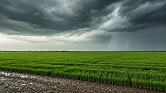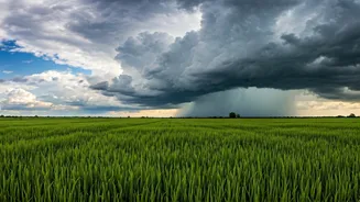


A Much-Needed Arrival
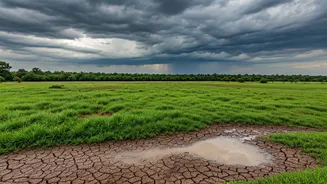
After a delayed and sluggish start, the Southwest Monsoon has finally gained some momentum, advancing into crucial agricultural regions of Maharashtra, Chhattisgarh, Odisha, and Madhya Pradesh. This push brings relief from scorching summer heat and provides
a critical window for farmers to begin sowing their Kharif (summer) crops, such as rice, soybean, and cotton. The India Meteorological Department (IMD) has confirmed this progress, noting that conditions are becoming favourable for the monsoon to cover more parts of the country in the coming days. For millions, the sight of dark clouds and the sound of rain are a sign of hope after a tense wait.
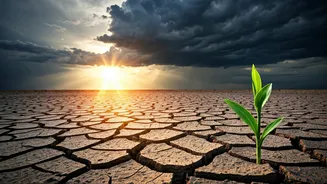
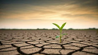
The Story of the Deficit
Despite the recent progress, the bigger picture remains concerning. The monsoon's onset over Kerala was delayed, and its initial journey northward was weak and erratic. This resulted in a significant rainfall deficit for the country in June, a crucial month for agriculture. At the end of the first month of the season, all-India rainfall was substantially below the long-period average (LPA). This initial shortfall has put pressure on water resources, with reservoir levels in many parts of southern and western India dipping to alarming lows. The current spell of rain is helping to close this gap, but the country is still playing catch-up.
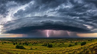
The Shadow of El Niño
The primary reason for the IMD's 'below-normal' forecast is the development of El Niño conditions in the Pacific Ocean. El Niño is a climatic pattern characterized by the unusual warming of surface waters in the eastern equatorial Pacific. This phenomenon disrupts global weather patterns and has a strong historical correlation with suppressed monsoon rainfall in India. While it doesn't guarantee a drought, a strong El Niño significantly increases the probability of a deficient monsoon. Forecasters believe that El Niño will likely strengthen during the latter half of the monsoon season, potentially impacting the vital rainfall months of August and September.
What 'Below-Normal' Really Means
When the IMD forecasts a 'below-normal' monsoon, it means it expects the total rainfall for the four-month season (June to September) to be between 90% and 96% of the Long Period Average. While this may not sound catastrophic, even a small deficit can have significant consequences. About 50% of India's farmland is rain-fed, making the rural economy deeply vulnerable to monsoon performance. A deficient monsoon can lead to lower crop yields, rising food prices (inflation), reduced rural incomes, and increased demand for government support schemes. It also impacts the replenishment of reservoirs, which are vital for drinking water supply, hydroelectric power generation, and winter crop irrigation.
Not One Monsoon, But Many
It's crucial to remember that the all-India forecast is an average. The monsoon's performance can vary dramatically from one region to another. Even in a 'below-normal' year, some parts of the country could experience normal rainfall or even devastating floods, while others face severe drought. This uneven distribution is a key challenge. The current rains in Central India are a perfect example of this variability. While they bring cheer to one region, parts of the east and south may still be waiting for meaningful showers. The performance of the monsoon in the core agricultural belts of the northwest and central plains will be the most critical factor to watch.