






A New Eye in the Sky
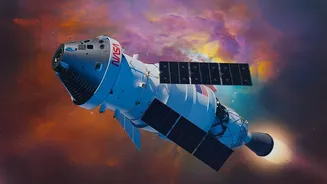
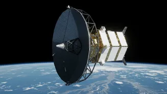
The game-changer is the NASA-ISRO Synthetic Aperture Radar, or NISAR, satellite. Successfully launched in July 2025, this advanced Earth-observation mission is a testament to the growing scientific partnership between the United States and India. It is the first
satellite mission to use two different radar frequencies—L-band and S-band—to measure changes on our planet's surface with unprecedented accuracy, down to the centimetre. Circling the Earth in a near-polar orbit, NISAR revisits the same spot every 12 days, systematically scanning nearly all of our planet's land and ice. This constant, reliable monitoring is what makes it so powerful for tracking dynamic events like floods.
Seeing Through Clouds and Darkness
One of the biggest challenges in monitoring floods during India's monsoon season is persistent cloud cover. Traditional optical satellites are often blind during the very storms that cause flooding. NISAR overcomes this limitation because it uses radar. Instead of a camera that needs light, it sends microwave signals to the Earth and analyses the echo that bounces back. This allows it to gather data day or night, and most importantly, through thick clouds and heavy rain. Furthermore, its L-band radar can penetrate vegetation canopies, meaning it can detect floodwaters hidden beneath forests and agricultural fields—areas often invisible to other satellites. This all-weather, all-hours capability ensures that disaster management agencies get a clear picture when they need it most.
Faster Than the Floodwaters
In a disaster, speed is everything. The headline promise of NISAR is that it makes flood monitoring 'faster and more effective', and the technology delivers on this. Previous methods of assessing floods relied on sparse ground-based river gauges or slower satellite data. NISAR acts like a network of 'virtual stream gauges' across the entire country, providing continuous maps of water level changes. Data from the satellite is expected to be available to scientists and disaster response teams within hours of an observation, a dramatic improvement over the days it could sometimes take previously. This speed allows authorities to see not just where flooding has occurred, but how it is evolving in near-real-time. They can track the flood wave as it moves downstream, providing crucial lead time for communities in its path.
From Data to Action on the Ground
This wealth of new data is not just an academic exercise; it's designed for real-world impact. ISRO has already started releasing data products from NISAR's S-band radar over the Indian landmass via its Bhoonidhi portal. This information feeds directly into national and state disaster management agencies. With high-resolution maps showing the precise extent of inundation, officials can make critical decisions more effectively. They can identify the safest evacuation routes, pinpoint villages that are cut off, and strategically deploy rescue teams and relief supplies to the areas of greatest need. After the waters recede, the same data provides an accurate and rapid assessment of the damage to homes, infrastructure, and crops, which is essential for recovery and for processing claims under schemes like the Pradhan Mantri Fasal Bima Yojana.
A Landmark Scientific Partnership
NISAR represents more than just a technological leap; it is a symbol of the deep collaboration between the world's leading space agencies. The mission's hardware was jointly developed, with NASA providing the L-band radar and ISRO contributing the S-band radar and the GSLV launch vehicle. This sharing of expertise and resources has created an instrument more powerful than either agency could have developed alone. By making the data free and open to the public and scientific community, NASA and ISRO are ensuring its benefits extend beyond just government agencies. Researchers, NGOs, and innovators can now use this information to develop new applications, improve climate models, and build a more comprehensive understanding of India's complex water challenges, from floods to droughts and groundwater depletion.