



A Small Satellite on a Giant Mission
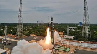
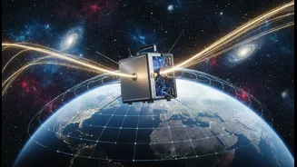
On July 7, 2026, a satellite no bigger than a suitcase was launched into orbit with a goal that could have massive implications for science and technology. Known as GRITSS, which stands for Geodetic Reference Instrument Transponder for Small Satellites,
this NASA-led technology demonstration aims to revolutionize how we measure our planet. Developed in partnership with the University of Massachusetts Lowell and Dutch aerospace firm ISISPACE, the compact satellite is designed to solve a long-standing challenge in global positioning, promising accuracy down to the millimeter. Its mission isn't just to improve the blue dot on your map, but to sharpen our understanding of the Earth itself, from shifting continents to rising sea levels.
The Global Positioning Puzzle
Our planet's position and orientation in space are constantly monitored by a combination of sophisticated techniques. The most familiar is the Global Navigation Satellite System (GNSS), which includes GPS. But scientists also rely on two other highly precise methods: Very Long Baseline Interferometry (VLBI), which uses radio telescopes to track distant cosmic objects, and Satellite Laser Ranging (SLR), which bounces lasers off satellites. Each system is incredibly powerful, but they all speak a slightly different technical language. When data from these independent networks is combined to create the global standard—the International Terrestrial Reference Frame (ITRF)—tiny errors, known as 'site tie' errors, creep in. These millimeter-level discrepancies can impact the accuracy of long-term climate studies and geodetic science.
GRITSS: The Universal Translator in Orbit
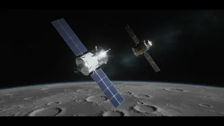
GRITSS acts as a clever interpreter in space, creating a common reference point that all three ground systems can see and understand simultaneously. The satellite is equipped with a special GPS receiver, transmitters, and a laser retroreflector. Here’s how it works: GRITSS orbits the Earth, captures standard GPS signals, and then converts and rebroadcasts them in frequencies that the powerful VLBI radio telescopes on the ground can detect. At the same time, SLR stations can bounce lasers off its retroreflector. By serving as a single, unified target for all three networks, GRITSS allows scientists to perfectly align their measurements and eliminate the small errors that have plagued the system, creating a far more stable and accurate global grid.
Why Millimeters Matter for India
An improvement of a few millimeters might not sound like much, but on a planetary scale, it's a game-changer. For India, with its vast coastline, this level of precision is critical for accurately monitoring sea-level rise and its impact on coastal communities. It enables more precise tracking of groundwater depletion, a crucial issue for the nation's agricultural sector. Furthermore, enhanced accuracy in the ITRF can help in monitoring tectonic plate movements in seismically active regions like the Himalayas, providing better data for earthquake risk assessment. For industry, this means more reliable positioning for logistics, autonomous vehicle navigation in dense urban environments, and infrastructure monitoring to detect subtle land subsidence under cities and major projects. This mission is laying the groundwork for a future where navigation and Earth science are one and the same.
The Future of Pinpoint Accuracy
The GRITSS mission, now in its operational phase, is fundamentally a test. Its success will demonstrate that geodetic-quality instruments can be packed into small, cost-effective CubeSats. The engineering behind it is remarkable, featuring an ultra-stable oscillator and thermal controls to keep its internal temperature from fluctuating more than a single degree, ensuring its timing remains accurate to a trillionth of a second. If this technology proves as effective as hoped, it could be integrated into future satellite constellations. This would not only reinforce the foundation of all modern navigation but also enhance our ability to track climate change with unprecedented detail. It represents a significant step towards a future where our understanding of Earth is measured not in meters, but in millimeters.