


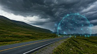


1. The Digital Gateway: Mastering Permits Online
The first 'secret' pathway isn't on a map; it's on a government website. Sikkim has restricted areas requiring permits like the Protected Area Permit (PAP) for foreigners and the Restricted Area Permit (RAP) for Indian citizens visiting places like Nathu
La, Gurudongmar Lake, and Yumthang Valley. In the past, this meant queues and paperwork in Gangtok. Today, the digital pathway starts at the official Sikkim Tourism portal. You can pre-register and understand the exact documentation needed. While final stamping often happens in person, having your digital forms in order saves hours, allowing you to get on the road faster. This is the foundational step every savvy backpacker masters before even packing their bags.
2. The Community Compass: Reddit & Facebook Groups
The most valuable secrets are shared, not sold. Online communities are your real-time travel guide. Subreddits like r/solotravel and r/IndiaMike have extensive threads where backpackers share current road conditions, reliable homestay contacts, and warnings about tourist traps. But the real gold is in niche Facebook groups. Search for terms like 'Backpacking North East India' or 'Sikkim Road Trips'. Here, members post daily updates on weather, landslide risks, and even find travel partners for shared taxis. Someone who just finished the Goechala trek might share their guide's contact, or a solo traveller in Yuksom might post about a local festival happening that night. This is the living, breathing map that no app can replicate.
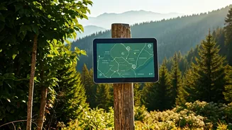
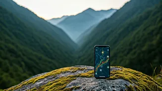
3. The Lifeline: Offline Maps & Navigation
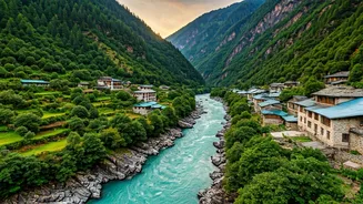
Once you leave Gangtok, mobile connectivity becomes a luxury, not a guarantee. This is where relying solely on Google Maps online can lead you astray. Experienced solo travellers swear by apps with robust offline capabilities. Maps.me is a long-standing favourite because its user-sourced data often includes hiking trails and small village paths not found on mainstream maps. Before your trip, download the entire map of Sikkim. Another pro-tip is to use the 'Download offline map' feature on Google Maps for specific regions you plan to visit. Pinning potential homestays, ATMs, and viewpoints beforehand creates a custom, reliable navigation tool that works even when you're completely off the grid in a remote valley like Dzongu.
4. The Transport Hack: WhatsApp Coordination
Shared taxis are the lifeblood of budget travel in Sikkim, but finding one that’s leaving at the right time can be chaotic. Here’s the digital hack: many local taxi drivers and tour operators run informal WhatsApp groups. When you book a cab or even a homestay in a town like Pelling or Lachen, ask to be added to one. These groups are a flurry of activity, with drivers posting their travel plans for the next day ('Gangtok to Yuksom, 3 seats left') and travellers posting their needs ('Looking for 2 people to share a cab to Gurudongmar Lake tomorrow'). It’s a dynamic, peer-to-peer system that allows solo backpackers to cut costs dramatically and move around the state with surprising efficiency.
5. The Shelter Network: Finding Authentic Stays
While major booking platforms are useful for cities, the soul of Sikkim is in its family-run homestays. Finding them used to be a matter of luck. Now, a multi-pronged digital approach works best. Many authentic homestays in places like Okhrey or Ravangla are now listed on Google Maps with a phone number and user photos. Don't book online; call them directly for better rates and to get a feel for the host. Furthermore, the Facebook groups mentioned earlier are a treasure trove of direct homestay recommendations, bypassing commission-based sites entirely. Travellers will share the host's name and number, ensuring you connect with trusted, welcoming families that provide a true cultural experience.
6. The Safety Check: Weather & Altitude Tools
In the Himalayas, the weather is the ultimate authority. Solo travellers must be prepared. Beyond standard weather apps, experienced trekkers use specialised services that provide more accurate high-altitude forecasts. Websites like AccuWeather and the Indian Meteorological Department (IMD) offer detailed regional forecasts. More importantly, digital tools can help you understand and mitigate the risk of Acute Mountain Sickness (AMS). Before attempting high-altitude journeys to places like North Sikkim, use online resources to read up on acclimatisation schedules, symptoms, and prevention. Knowing the difference between normal fatigue and the early signs of AMS is a critical piece of knowledge that your smartphone can deliver, making your adventure both thrilling and safe.