






An Unblinking Eye in the Sky
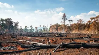
Imagine trying to patrol millions of square kilometres of dense, often remote forest on foot. It’s an impossible task. This is the challenge environmental scientists and conservationists face. Deforestation, whether from illegal logging, agricultural
expansion, or wildfires, often happens in areas that are vast and difficult to access. Satellite technology provides a solution by offering a comprehensive and timely overview that ground surveys alone cannot achieve. By capturing images of the same area over time, scientists can compare them to spot changes, a technique known as time-series analysis. This allows them to track not just where forest has disappeared, but also to monitor the health and density of the forest that remains.
More Than Just a Picture
The images scientists use are far more advanced than a typical photograph. Satellites are equipped with different types of sensors that capture information across various wavelengths of light, many of which are invisible to the human eye. Optical sensors work like powerful digital cameras, capturing visible light to assess vegetation health. However, they are often useless in tropical regions with persistent cloud cover. This is where Synthetic Aperture Radar (SAR) comes in. SAR sensors use radio waves that can penetrate clouds, smoke, and darkness, providing uninterrupted monitoring. They are highly sensitive to changes in forest structure, making them excellent at detecting even small clearings. Thermal sensors add another layer, detecting heat radiation to identify and track the spread of forest fires, often before they are visible on the ground.
AI Joins the Watch
Collecting terabytes of satellite data is one thing; making sense of it is another. This is where Artificial Intelligence (AI) and machine learning have become game-changers. Algorithms are trained on vast datasets of satellite imagery to automatically recognize the patterns of deforestation. They learn to distinguish between a natural clearing and a man-made road, or between seasonal changes and permanent forest loss. Platforms like Global Forest Watch (GFW), a free online system developed by the World Resources Institute, use these technologies to provide near real-time deforestation alerts. Anyone, from a government official to a concerned citizen, can subscribe to alerts for a specific area and receive notifications when suspected clearing is detected, enabling rapid response.
The Indian Context
India has its own robust satellite monitoring programme, driven by the Indian Space Research Organisation (ISRO). The Forest Survey of India (FSI) uses data from ISRO’s satellites to produce its biennial 'State of Forest Report', a comprehensive assessment of the country's forest cover. ISRO has developed advanced monitoring systems that combine remote sensing, AI, and automation to detect even small-scale deforestation and improve reporting frequency. Furthermore, the landmark NASA-ISRO Synthetic Aperture Radar (NISAR) satellite, which became operational in 2025, is a significant leap forward. Its advanced radar scans nearly all of India's forests every 12 days, seeing through clouds and darkness to track even subtle ecosystem damage and degradation.
From Data to On-the-Ground Action
The ultimate goal of all this high-tech monitoring is to drive action on the ground. When GFW or an agency like the FSI issues an alert for illegal logging or a forest fire, it triggers a response. Law enforcement can be dispatched to investigate the precise coordinates, NGOs can launch campaigns to hold companies accountable for deforestation in their supply chains, and firefighters can be directed to the source of a blaze. For example, near real-time data from NASA's MODIS and VIIRS sensors helps the FSI alert state forest departments to fire hotspots, allowing for quicker containment. This technology provides a level of transparency and accountability that was previously impossible, empowering people to protect forests.
Challenges and the Road Ahead
Despite incredible advances, satellite monitoring isn't a silver bullet. A major challenge, particularly in India, is bridging the gap between data collection and institutional response. Sophisticated systems like NISAR provide an unprecedented amount of data, but without the downstream infrastructure to quickly process these alerts and empower local authorities to act, the information's potential is lost. The data can flag a problem, but it cannot deploy a ranger or put out a fire. The effectiveness of this technology hinges on building the governance structures to turn these digital alerts into swift, decisive, and well-resourced action on the ground. As the technology continues to evolve, so too must the systems designed to use it.