






The New Rhythm of the Monsoon
The predictable rhythm of the Indian monsoon, a lifeline for agriculture and ecosystems, is changing. Scientists have observed that it's no longer just about the total volume of rain that falls each year. Instead, the character of the rainfall is shifting.
Recent analyses show an increase in the frequency and intensity of extreme rain events, often concentrated in short, powerful bursts. These downpours are frequently followed by longer-than-usual dry spells, creating a volatile swing between flood and drought conditions, sometimes within the same season. This erratic behaviour, influenced by factors like global warming and El Niño, means that while one part of the country might be dealing with landslides from intense rain, another could be facing water scarcity. This growing unpredictability is the new reality that farmers, water managers, and entire ecosystems must now navigate.
A Complicated Greening Picture
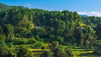
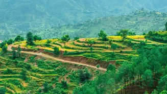
On the surface, parts of India appear to be getting greener. Studies, some using satellite data, have pointed to a 'greening' trend in certain regions, including the Thar Desert in the northwest, driven by increased rainfall and human interventions like irrigation. However, this green veneer can be misleading. This newfound vegetation is often highly dependent on specific rainfall patterns and groundwater, which is itself under strain. In other regions, particularly the forests of central India, the story is one of stress and degradation. Changes in precipitation, combined with rising temperatures, are increasing the risk of forest fires and altering the natural life cycles of trees. For instance, dry deciduous forests, which are more sensitive to moisture stress, have shown significant canopy loss. So while some arid areas might be greening, established, biodiverse forests are becoming more vulnerable.
The View from a Satellite and the Soil
To understand these complex changes, scientists combine data from the sky and the ground. Satellites equipped with sensors measure the 'Normalized Difference Vegetation Index' (NDVI), which essentially tracks the greenness and health of vegetation over vast areas. This allows researchers to monitor long-term trends across the entire subcontinent, from dense forests to agricultural lands. But satellite data only tells part of the story. This information is cross-referenced with decades of on-the-ground rainfall data from meteorological stations. By combining these two sources, scientists can directly link changes in vegetation vigour to specific shifts in rainfall seasonality and intensity. This dual approach helps separate the effects of natural climate cycles from the growing fingerprint of long-term climate change, providing a more robust picture of how India's landscapes are responding.
Impact on Forests and Farms
The consequences of these rainfall shifts are profound for both natural ecosystems and agriculture. A study in the Panchmarhi Biosphere Reserve in central India found that a shift in rainfall away from the post-monsoon period, coupled with warming, contributed to a 13% loss of forest cover over several decades. For India's farmers, who have timed their planting cycles to the monsoon for generations, this new unpredictability is a major challenge. A delayed onset of rains can disrupt sowing, while a sudden, intense downpour can wash away young seedlings, leading to crop losses. Studies indicate that yields of critical crops like rice could be reduced in the coming decades due to these changes. The impact is not uniform; some regions may see rainfall increase, but this often comes in the form of destructive, extreme events that damage crops and infrastructure.