






El Niño: The Famous Culprit
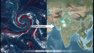
For many, El Niño is the primary villain behind a weak monsoon. This phenomenon involves the unusual warming of the surface waters in the eastern and central Pacific Ocean. This change in ocean temperature disrupts global weather patterns. For India,
it often means a weaker monsoon because it can pull moisture-laden air away from the subcontinent. Historically, many of India’s most severe droughts have coincided with strong El Niño years. However, this connection is not a guarantee. Some El Niño years have seen normal or even above-average rainfall, pointing to the fact that other, more powerful forces are at play closer to home.
The Indian Ocean's Own System: The IOD
The Indian Ocean has its own version of El Niño, known as the Indian Ocean Dipole (IOD). This refers to the temperature difference between the western Indian Ocean (near the African coast) and the eastern Indian Ocean (near Indonesia). When the western part is warmer, we have a 'positive' IOD. This phase pushes more moisture towards India, strengthening the monsoon. A 'negative' IOD does the opposite. A strong positive IOD can sometimes be powerful enough to counteract the negative effects of an El Niño, essentially rescuing the monsoon season from drought. The interplay between El Niño in the Pacific and the IOD in the Indian Ocean is a key reason why long-range forecasts can be so tricky.
The Wild Card: The Madden-Julian Oscillation
A lesser-known but critical factor is the Madden-Julian Oscillation (MJO). Think of it as a massive, eastward-moving pulse of clouds and rainfall that travels around the equator every 30 to 60 days. When the MJO is in its active phase over the Indian Ocean, it can significantly boost rainfall and even trigger the onset of the monsoon. When it's in a suppressed phase, it can lead to long dry spells, or 'breaks,' within the monsoon season itself. Unlike El Niño or the IOD, which set a background state for the season, the MJO is an intra-seasonal force, making it a wild card that can determine the timing and intensity of rainfall on a much shorter timescale.
The Unmovable Force: India's Topography
Perhaps the most unique and constant factor is India’s own geography. The towering Himalayas in the north and the Western Ghats along the coast are not just landmarks; they are the engines of the monsoon. The Himalayas act as a massive barrier, preventing cold northern air from entering and trapping the monsoon's moisture over the subcontinent. The Western Ghats are the first obstacle the moisture-laden winds from the Arabian Sea encounter. They are forced to rise, cool, and release enormous amounts of rain on the windward side. This orographic effect creates intense regional variations that large-scale global models often struggle to capture accurately, leading to discrepancies between national forecasts and local realities.
The Human Element
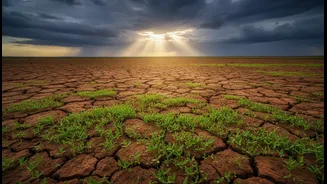
Finally, human activity adds another layer of unpredictability. Atmospheric pollutants like aerosols can alter the properties of rain-bearing clouds, sometimes leading to weaker monsoon showers but more intense, extreme rainfall events. Changes in land use, such as deforestation and urbanization, can affect local moisture recycling and rainfall patterns. As climate change intensifies, these factors are expected to make the monsoon even more erratic, with longer dry spells punctuated by destructive deluges. This makes accurate forecasting not just a scientific challenge, but a critical component of national resilience.