








A Monsoon of Two Minds
The start of July 2026 brought a confusing mix of weather across India. While the India Meteorological Department (IMD) had forecasted a below-normal monsoon for the month, influenced by a weak El Niño, the reality on the ground was one of stark contrasts.
Mumbai, for example, received its entire average rainfall for July in the first week alone. At the same time, other parts of the country, which had experienced a very dry June, were still waiting for significant relief. This uneven distribution, with intense downpours in some pockets and prolonged dry spells elsewhere, left many wondering what was driving the monsoon's seemingly contradictory behaviour. The confusion was heightened by the fact that after a rapid advance in late June and early July that erased some of the country's rainfall deficit, models began suggesting another weak phase could set in after July 13.
The View from 36,000 Kilometres Up
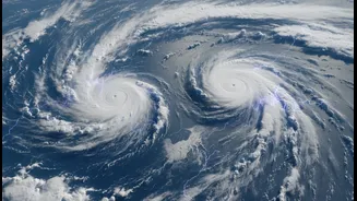
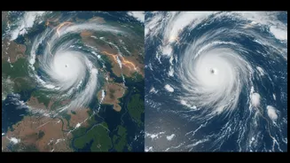
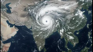
The key to decoding this meteorological puzzle has come from satellites like ISRO's INSAT-3DR. Orbiting high above the Earth, these eyes in the sky provide a constant, comprehensive view of atmospheric conditions that ground stations alone cannot. In recent days, satellite imagery has been crucial in identifying two massive, distinct monsoon systems operating simultaneously. One was a sprawling system in the Arabian Sea, pulling moisture into the Konkan coast and causing the deluge in Maharashtra. The other was a powerful system in the Bay of Bengal, drenching West Bengal and the northeastern states. These high-resolution images, particularly in the infrared spectrum, show the temperature of cloud tops; extremely cold, bright white clouds indicate deep, powerful thunderstorms capable of producing very heavy rain.
Connecting the Dots on the Map
Satellite data does more than just show clouds; it helps meteorologists identify and track the larger systems that organise the weather. The recent active spell was driven by the season's first significant low-pressure area, which formed over the Bay of Bengal and moved inland across Odisha and Chhattisgarh. These low-pressure systems act like engines, drawing in moisture and strengthening the monsoon trough—an elongated area of low pressure that is a lifeline for rainfall across the northern plains. By tracking the movement and intensity of these systems via satellite, forecasters can issue more accurate warnings for heavy rainfall. The imagery confirmed that while an overarching El Niño pattern might suggest a weaker season, potent, short-term systems can still deliver intense, localised rainfall.
What Does This Mean for the Week Ahead?
The clarity provided by satellite views allows for a more nuanced forecast. The IMD's press release from July 7th, informed by this data, detailed specific regional outlooks. Widespread rainfall is expected to continue over northwest India, including Himachal Pradesh and Uttarakhand, as well as parts of central India for the next few days. However, the active spell is not permanent. Weather models, validated by satellite observations of atmospheric patterns, indicate a potential weakening of the monsoon trough around July 13th. This could lead to a 'break' or suppressed phase, particularly for western, central, and southern India, lasting until around July 20th. This on-again, off-again pattern is a classic feature of monsoon dynamics, but it's the view from space that makes its timing and impact far less of a surprise.