







Decoding NASA’s New Mission
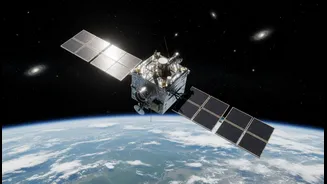
GRITSS stands for Geodetic Reference Instrument Transponder for Small Satellites. It’s a technology demonstration mission from NASA, housed in a compact CubeSat. Its primary goal isn’t to take stunning pictures of Earth, but to perform a critical, behind-the-scenes
task: to act as a universal calibration point in space. Think of it as a master tuning fork for the various systems we use to measure our planet, designed to make our global measurement framework more accurate than ever before.
The Problem of Multiple Rulers
Currently, the foundation for all modern positioning, the International Terrestrial Reference Frame (ITRF), is built by combining data from three different techniques: Satellite Laser Ranging (SLR), Very Long Baseline Interferometry (VLBI), and the Global Navigation Satellite System (GNSS). The challenge is that these systems are independent, and slight errors—known as “site tie” errors—creep in when combining their data. GRITSS is designed to solve this by being a single target in space that all three systems can observe simultaneously. By acting as a common reference, it allows scientists to directly tie these systems together and eliminate those nagging, millimeter-level discrepancies.
The Gain: A Millimeter of Progress
The stated goal of the GRITSS mission is to help achieve a 1-millimeter accuracy for the ITRF. While that may sound incredibly small, the implications are enormous. For scientists, this level of precision is crucial for tracking subtle but critical changes to our planet, such as rising sea levels, the melting of ice sheets, and the depletion of underground water resources. For the geospatial industry, a more accurate and stable reference frame means more reliable data for everything from precision agriculture and autonomous navigation to the development of next-generation topographical maps and digital twins for urban planning.
Why This Matters for India
This global technological advancement comes at a pivotal moment for India. The country's National Geospatial Policy 2022 is aggressively promoting the liberalization and democratization of location data to fuel a thriving digital economy. As Indian startups and established firms build sophisticated solutions for smart cities, infrastructure monitoring, and logistics, their work rests on the foundation of the global positioning framework. A more accurate ITRF, as promised by GRITSS, means that the data collected and applications developed in India will be more robust, reliable, and seamlessly interoperable on a global scale, strengthening the entire ecosystem.
What Still Needs Checking
Despite the immense potential, GRITSS is a technology demonstration, meaning several things still need to be verified. First is the on-orbit performance; having just launched in July 2026, the spacecraft and its instruments must go through a commissioning phase to prove they work as designed. Second is the process of data integration. It will take time for the global scientific community to process the new data from GRITSS and formally update the ITRF. Finally, there's the question of downstream adoption: how long will it take for this foundational improvement to filter down into the commercial software, hardware, and services that geospatial professionals in India and elsewhere use in their daily work?