





Seeing the Unseen: What is SAR?
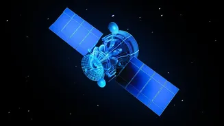
Imagine a satellite that can take high-resolution pictures of Earth not just on a clear, sunny day, but also through thick clouds, heavy rain, and even in the dead of night. That's the power of Synthetic Aperture Radar (SAR). Unlike traditional optical
satellites that capture light like a camera, SAR is an active system. It sends its own microwave pulses down to the ground and records the echoes that bounce back. This allows it to create detailed images regardless of weather or time of day, a crucial advantage for a country like India with its diverse and dynamic climate, including monsoon seasons. This technology doesn't just see surfaces; it can measure subtle changes, like ground moisture or millimeter-scale shifts in the Earth's crust, providing a much richer dataset than a simple photograph from space.
India's All-Weather Eye in the Sky
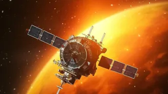
ISRO's investment in SAR is a strategic move. A key driver is the recently operational NASA-ISRO SAR (NISAR) mission, a landmark collaboration that is one of the most advanced Earth observation satellites ever built. Launched in 2025, NISAR uses two different radar frequencies (L-band and S-band) to systematically map the entire globe every 12 days. This provides an unprecedented ability to monitor critical changes related to agriculture, forestry, and natural hazards. For India, this technology is vital for disaster management, enabling near real-time tracking of floods, landslides, and cyclones. It also plays a key role in national security, agricultural monitoring to ensure food security, and tracking changes in glaciers and coastlines, which are critical in an era of climate change. In July 2026, ISRO began releasing NISAR's S-Band data products to the public via its Bhoonidhi portal, opening the doors for widespread use.
The New Skillset in High Demand
This technological push has created a significant demand for a new generation of remote-sensing professionals with specialised skills. Simply knowing how to operate GIS software is no longer enough. The industry now needs experts who can handle the complexities of SAR data. Key skills include understanding microwave remote sensing principles, processing complex radar data, and interpreting SAR imagery, which can be less intuitive than optical photos. Proficiency in programming languages like Python for automating data analysis and experience with machine learning to identify patterns in vast datasets are becoming essential. Expertise in techniques like Interferometric SAR (InSAR), which measures ground deformation, and Polarimetric SAR (PolSAR), which reveals details about the physical structure of objects, are highly valued.
From Classroom to a Career at ISRO and Beyond
The career opportunities for students equipped with these SAR skills are expanding rapidly. ISRO and its various centers, like the National Remote Sensing Centre (NRSC) and Space Applications Centre (SAC), are primary recruiters for roles like scientists and image analysts. However, the opportunities extend far beyond government jobs. With the opening of the space sector, private companies in India are increasingly using geospatial data for applications in agriculture, infrastructure, and insurance, creating a wealth of new roles. Furthermore, expertise in SAR is sought after in disaster management agencies, environmental consulting firms, and urban planning departments. The demand for trained personnel currently outstrips supply, creating a favorable job market for graduates with the right training.
How Aspiring Students Can Get Ahead
For remote-sensing students looking to specialise in this domain, proactive learning is key. It starts with a strong foundation in physics and mathematics. Beyond the core curriculum, students should seek out specialised courses and training programs in microwave remote sensing. Recognising this need, ISRO and other agencies occasionally organise workshops and short-term courses on SAR data analysis. Students can also gain hands-on experience by working with freely available SAR data from missions like NISAR and Europe's Sentinel-1. Resources like NASA's SAR Handbook provide comprehensive tutorials and datasets for forest monitoring and biomass estimation. Focusing final-year projects on real-world problems using SAR data—such as monitoring a local water body, analysing urban sprawl, or studying cropping patterns—can provide invaluable practical experience and a significant advantage in the job market.