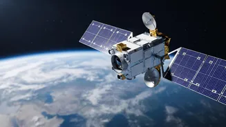





A Second Chance at a 'Sky Eye'
The upcoming launch of EOS-05, also known as GISAT-1A, is one of the most anticipated missions for the Indian Space Research Organisation (ISRO). This isn't just another satellite; it's a redemption mission. Its predecessor, EOS-03 (or GISAT-1), was lost
in a heartbreaking launch failure in August 2021 when the GSLV rocket's cryogenic upper stage malfunctioned. That event left a critical gap in India's planned observational infrastructure. Now, five years later, EOS-05 is set to fill that void, carrying not just advanced imaging technology but also the hopes of the nation's scientific community. The mission, scheduled to lift off from Sriharikota aboard a GSLV-F17 rocket, represents a crucial step forward after a period of setbacks and analysis.
What Makes This Satellite Different?
Most Earth observation satellites operate in a Low Earth Orbit (LEO), circling the globe and passing over a specific area only at certain times. EOS-05 is designed for a far more powerful position: a geostationary orbit, approximately 36,000 kilometres above the Earth's equator. At this altitude, the satellite's speed matches the Earth's rotation, allowing it to remain seemingly stationary over the Indian subcontinent. This unique vantage point transforms it from a periodic visitor into a persistent watchdog. Instead of getting snapshots, India will have the ability to continuously monitor a vast area, a capability few nations possess.
A Game-Changer for Disaster Management
The true power of this persistent gaze becomes clear during natural disasters. Cyclones, floods, and forest fires are fast-evolving events where every minute counts. A traditional satellite might miss the crucial hours of a storm's formation or a fire's spread. EOS-05, however, is designed to provide near real-time imagery of the entire Indian landmass every 30 minutes, with the ability to focus on a specific area of interest for a new image every five minutes. This rapid revisit capability will empower disaster management agencies to track threats as they develop, issue more accurate and timely warnings, and coordinate rescue and relief efforts with an unprecedented level of situational awareness.
Enhancing National and Economic Security
Beyond natural disasters, the strategic implications of EOS-05 are profound. Continuous monitoring of borders and maritime regions provides a significant advantage for national security. The ability to observe areas of interest without the predictable overpass schedule of a LEO satellite adds a layer of strategic depth. Furthermore, the applications extend to the economy. The satellite’s multispectral and hyperspectral imagers can be used for a wide range of applications, including monitoring agricultural health, water resources in reservoirs, forest cover, and mineralogy. This data can inform policy, improve crop yields, and help manage vital natural resources more effectively, providing benefits that touch everything from farming to urban planning.
The Road Ahead for ISRO
The successful launch and operation of EOS-05 would be a major milestone, re-establishing confidence in the GSLV launch vehicle, especially its complex cryogenic stage. The mission is part of ISRO's broader Earth Observation Satellite (EOS) programme, which has already provided crucial data for decades across various sectors. As India continues to expand its space capabilities, with future missions planned for the Moon and Venus, foundational assets like EOS-05 are critical. They not only provide direct services to the nation but also demonstrate the country's growing technological prowess and its commitment to using space for sustainable development and security.