







What Exactly is Satellite Data Analysis?
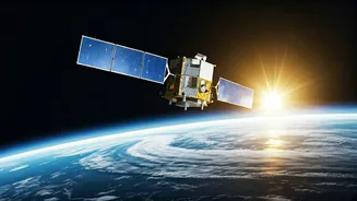
At its core, satellite data analysis, also known as remote sensing or geospatial analysis, is the skill of interpreting images and data collected by satellites orbiting Earth. Think of it as being able to see the big picture—literally. These are not just
photographs; satellites capture information across different wavelengths, revealing details invisible to the naked eye. This allows analysts to monitor crop health, track deforestation, map urban sprawl, measure air quality, and even help in disaster relief efforts by assessing damage from floods or earthquakes. By combining this data with Geographic Information Systems (GIS), professionals can create detailed maps and models that turn raw information into actionable insights for businesses and governments.
India's Geospatial Boom: Why Demand is Soaring
India's geospatial market is on a trajectory of explosive growth. Valued at thousands of crores, the industry is expanding at a remarkable rate annually, with projections suggesting it could become a ₹1 lakh crore industry by 2030. This surge is powered by several key government initiatives. Flagship programmes like the Smart Cities Mission, PM Gati Shakti, Digital India, and the push for smart agriculture all rely heavily on geospatial data for planning, execution, and monitoring. Furthermore, progressive policies have opened up the space sector, encouraging private companies and startups to innovate and create new applications for satellite data. This convergence of public policy and private sector ambition is creating a massive demand for skilled professionals who can turn satellite data into solutions.
From Farms to Fintech: Where the Jobs Are
The applications for satellite data are incredibly diverse, creating job opportunities across a wide spectrum of industries. In agriculture, analysts help improve crop yields and promote precision farming by monitoring soil moisture and plant health. Urban planners use this data to manage city growth and develop better infrastructure. In disaster management, geospatial experts are crucial for planning and executing emergency responses. The field is also making inroads into new sectors like banking and finance for risk assessment, insurance for claim verification, and logistics for supply chain optimisation. Companies like ISRO, along with a growing number of private firms and startups, are actively hiring for roles such as GIS specialist, remote sensing analyst, and geospatial data scientist.
The Analyst's Toolkit: Core Skills You Will Need
To build a career in this field, a specific set of technical and soft skills is required. Proficiency in GIS software like ArcGIS and the open-source QGIS is fundamental. Knowledge of remote sensing—understanding how to process and interpret satellite imagery—is equally important. Increasingly, employers look for programming skills, especially in Python, which is used to automate tasks and perform complex data analysis. Familiarity with databases and data management principles is also necessary to handle the vast amounts of information involved. Beyond the technical, strong problem-solving and communication skills are essential to translate complex data into clear insights for non-technical stakeholders.
Your Launchpad: How to Get Started
Embarking on a career in satellite data analysis is more accessible than ever. For those starting out, a bachelor's or master's degree in a related field like geoinformatics, geography, or even computer science provides a strong foundation. However, you don't necessarily need a specialised degree. Many professionals transition into this field by taking up online courses and certifications. Platforms offer courses on GIS, remote sensing, and Python for geospatial analysis. India's own premier institutes, like the Indian Institute of Remote Sensing (IIRS) in Dehradun, offer a range of short courses, workshops, and e-learning programmes, many of which are available online. Building a portfolio with practical, hands-on projects is a great way to showcase your skills to potential employers.