




A Second Chance at a Constant Watch
The GISAT-1A, also designated EOS-05, represents a pivotal mission for the Indian Space Research Organisation (ISRO). It is fundamentally a second attempt after its predecessor, GISAT-1 (or EOS-03), was lost during a launch failure in August 2021 due
to a technical anomaly in the GSLV rocket's cryogenic upper stage. This new mission carries the weight of unfinished business, aiming to finally place a state-of-the-art imaging satellite into a geostationary orbit. Unlike most Earth observation satellites that circle the globe, GISAT-1A is designed to be a fixed sentinel, providing continuous, near real-time surveillance of the Indian subcontinent and its surrounding oceans.
The Geostationary Advantage
What makes this satellite special is its orbit. GISAT-1A will be positioned in a geostationary orbit, approximately 36,000 kilometres above the Earth's equator. At this specific altitude, the satellite's orbital period matches the Earth's rotation. From the ground, it appears to hover motionless over a single spot. This is a game-changer compared to ISRO's other remote sensing satellites, which are in low-Earth polar orbits and can only view a specific location for a few minutes during each pass. The geostationary perch allows for persistent monitoring, like a camera on an incredibly tall, fixed pole, enabling observation of rapidly developing events as they unfold.
An Advanced Set of Eyes
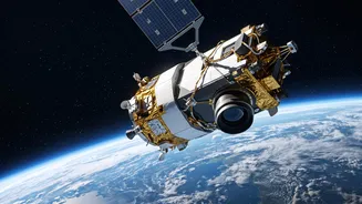
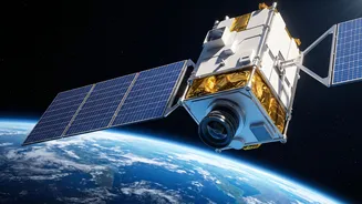
At the heart of GISAT-1A's mission are its advanced imaging payloads. The satellite is equipped with a 700mm telescope and sophisticated sensors that can see the Earth in multiple ways. It features multispectral imagers that capture light in the visible, near-infrared (VNIR), and shortwave infrared (SWIR) bands. This allows it to do more than just take pictures. By analysing these different spectral signatures, scientists can assess crop health, monitor water quality, track changes in forest cover, and even identify different types of minerals on the ground. The satellite is designed to be highly agile, capable of quickly steering to focus on specific areas of interest.
A Key Tool for Disaster Management
One of the primary objectives of the GISAT program is to radically improve India's ability to manage natural disasters. The satellite's ability to provide high-frequency imaging—capturing the entire Indian landmass roughly every 30 minutes and priority areas as often as every 5 minutes—is crucial for tracking dynamic events. This capability will enable authorities to monitor the development of cyclones in near real-time, track the spread of floods and forest fires, and get a clearer picture of landslide-prone areas. This constant stream of data strengthens early warning systems and helps in mobilising faster, more effective disaster response and relief efforts.
Enhancing National and Strategic Security
Beyond its civilian applications, GISAT-1A has significant strategic importance. While primarily a civilian satellite, its capability for persistent observation of the Indian subcontinent and bordering regions offers a substantial boost to the country's security apparatus. The ability to monitor large areas of interest for any changes can aid the armed forces in planning and operations. This continuous watch helps in keeping tabs on border activities, tracking maritime movements, and monitoring critical infrastructure without the long delays associated with orbiting satellites. This dual-use capability makes the GISAT program a vital national asset for both environmental and security monitoring.