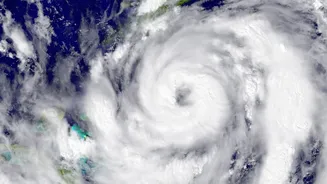








A Very Severe Cyclonic Storm, named Arnab, made landfall along the Andhra Pradesh coast on Wednesday morning. As it moves inland, its influence is extending far beyond the point of impact, triggering a cascade of weather alerts across the country.
Cyclone Arnab: Current Status and Path
Cyclone
Arnab completed its landfall process along the Andhra Pradesh coast, southwest of Yanam, between 2 a.m. and 8 a.m. on October 28. Classified as a 'Very Severe Cyclonic Storm' at the time of landfall, it brought sustained wind speeds of 125-135 km/h, with gusts reaching up to 150 km/h. By 8:30 a.m., after moving over land, the India Meteorological Department (IMD) downgraded it to a 'Severe Cyclonic Storm'. The system is expected to continue moving north-northwestwards, gradually weakening into a cyclonic storm and then a deep depression as it travels further inland over the next 24 to 48 hours.
The Ripple Effect: How One Cyclone Triggers Nationwide Weather
A cyclone is a massive, rotating engine of low pressure, fuelled by warm ocean water. Its immense power doesn't just stay contained within the storm's core. As Cyclone Arnab churns inland, it is disrupting larger atmospheric patterns. Think of it as a giant atmospheric pump: its powerful circulation pulls in vast amounts of moisture from the Bay of Bengal. This moisture is then transported hundreds of kilometres away. Furthermore, the system interacts with other weather patterns, like the withdrawing monsoon trough and incoming western disturbances. This interaction can enhance rainfall in regions that are not directly in the cyclone's path, essentially 'stealing' moisture and causing unseasonal or intensified downpours in distant states.
Red and Orange Alerts: Who Is Most Affected?
The most severe impacts are being felt along the storm's direct path. The IMD has issued 'extremely heavy rainfall' warnings for isolated places in coastal Andhra Pradesh, Odisha, and Chhattisgarh for October 28. Extremely heavy rainfall, exceeding 200 mm, has already been recorded in several locations in Andhra Pradesh, leading to flash flood warnings. A storm surge of up to 1.5 meters above the normal tide was also forecast, threatening to inundate low-lying coastal areas. 'Heavy to very heavy rainfall' is expected in Telangana and the Vidarbha region of Maharashtra. These regions are on high alert for flooding, uprooted trees, and damage to power and communication lines.
Yellow Alerts: The Widespread Indirect Impact
The cyclone's reach is extensive, putting many other states on a 'yellow' alert for heavy rainfall. This list includes Assam, Meghalaya, Nagaland, Manipur, Mizoram, Tripura, Gangetic West Bengal, Jharkhand, and East Madhya Pradesh. The influence of Cyclone Arnab is even interacting with a western disturbance over northern India. This has led to forecasts of thunderstorms and gusty winds for parts of East Uttar Pradesh and even the Delhi-NCR region, which could see rainfall between October 28 and 29. This demonstrates how a single major event in the Bay of Bengal can create a domino effect, altering weather patterns across the eastern, central, and northern parts of the country.
Essential Safety During Heavy Rains
With widespread rain and wind warnings in effect, authorities urge caution. It is crucial to stay indoors and avoid unnecessary travel. Do not touch loose or dangling electrical wires and stay away from damaged buildings or areas prone to waterlogging. Ensure your electronic devices and emergency lights are fully charged. Keep an emergency kit with essentials like drinking water, nonperishable food, first aid supplies, and any necessary medications. For the most current information, rely only on official updates from the IMD and local disaster management authorities. Avoid spreading rumours and pass on only verified information to others. If you are in a lowlying area or have been asked to evacuate, do so promptly.