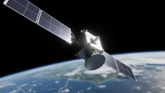




A Revolutionary Eye in the Sky
The NASA-ISRO Synthetic Aperture Radar, or NISAR, isn't just another satellite. Launched in July 2025, it is the first collaboration of its kind between the two space agencies, designed to track subtle changes on our planet's surface with unprecedented
detail. What makes it truly special is its technology. NISAR uses a sophisticated dual-frequency radar system (L-band and S-band) that can see through clouds and operate day or night. This is a significant advantage over traditional optical satellites, which are often hindered by weather and darkness. By bouncing radar signals off the Earth and measuring the return, it can detect surface movements as small as a centimetre. The satellite orbits the entire globe every 12 days, creating a consistent and reliable stream of information about everything from melting glaciers and shifting earthquake fault lines to the health of agricultural crops.
The Power of an Open Data Policy
Historically, high-resolution satellite data was expensive, restricted, or classified, limiting its use to well-funded government agencies and large corporations. The NISAR mission shatters this old model. In line with NASA's long-standing open data policy, all science data from the mission is being made freely and openly available to the public. In July 2026, both NASA and ISRO began releasing their respective L-band and S-band data to the public through online portals like NASA's Earthdata and ISRO's Bhoonidhi. This move democratises access to vital planetary information. Now, researchers, students, small businesses, and non-governmental organisations in India and across the world can access and analyse the same high-quality data that was once the domain of a select few. This shift is not just about generosity; it's about accelerating innovation and creating value. History, such as with the US Landsat program, shows that when Earth observation data is made free, its usage and the development of applications built upon it explode exponentially.
What This Means for India
For India, the benefits of NISAR's open data are immense and immediate. ISRO has identified key applications of particular relevance to the nation. The satellite's ability to monitor agricultural biomass can lead to more accurate crop yield predictions, bolstering food security and stabilizing markets. In a country prone to natural disasters, NISAR's data is a game-changer for disaster management. It can provide early warnings for floods, track land subsidence in rapidly growing cities, and help assess damage after earthquakes or cyclones, allowing for more effective response and recovery efforts. Furthermore, the detailed monitoring of Himalayan snow and glaciers will provide critical insights into water resources that are vital for millions of people downstream. From precision farming in Punjab to managing coastal resources in Tamil Nadu, the applications are as vast as the country itself.
A Growing Global Movement
NISAR's data release is a powerful affirmation of a global trend towards open science. It follows the path forged by other major initiatives, such as the European Union's Copernicus program, which has already demonstrated the profound economic and social benefits of providing free and open Earth observation data. By removing barriers to access, these programmes foster a collaborative global community working to address shared challenges like climate change, resource management, and sustainable development. The availability of this data fuels innovation, allowing developers to create new tools and services for a wide range of sectors, including insurance, infrastructure, and environmental protection. While challenges remain, particularly in storing and processing the massive volumes of data NISAR will generate, the tools and cloud-based platforms to handle them are also becoming more accessible.