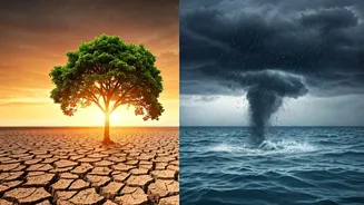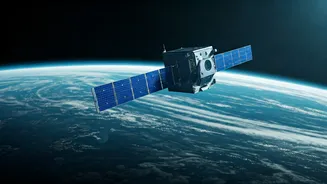


The Ultimate High Ground
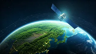
For decades, satellites have given us breathtaking images of our planet, from the iconic ‘Blue Marble’ photo to daily weather forecasts. But today’s technology goes far beyond simple photography. A new generation of advanced orbital sensors is providing
a continuous, high-resolution stream of data on the health of our planet. They can see things the human eye cannot, like the chemical composition of the air, the temperature of the ocean surface, and the moisture content of soil. This isn't just about collecting information for scientific papers anymore. This data provides an impartial, transparent, and near-real-time record of what’s happening on the ground. Think of it as a global audit system, operating 24/7 from hundreds of kilometres up. This shift from observation to actionable intelligence is what’s giving climate action its new orbital boost.
Pinpointing the Polluters
One of the biggest game-changers is the ability to track greenhouse gas emissions to their source. Methane, a potent greenhouse gas, is notoriously difficult to monitor as it’s invisible and odourless. Previously, we relied on estimates. Now, specialised satellites from organisations like Canada's GHGSat and the Environmental Defense Fund’s MethaneSAT can detect and pinpoint specific methane leaks from individual oil and gas facilities, pipelines, and even landfills. This creates an unprecedented level of accountability. When a satellite can identify a massive leak from a specific facility, there’s no room for denial. This data is being used by regulators to enforce emission standards and by companies themselves to fix costly leaks. It transforms the abstract problem of ‘emissions’ into a concrete, verifiable issue that can be addressed facility by facility.
Guarding Forests and Farms
Deforestation is a huge contributor to climate change, but tracking illegal logging across vast, remote jungles is a monumental challenge. Companies like Planet Labs operate a constellation of small satellites that image the entire Earth’s landmass every single day. This allows conservation groups and governments to spot deforestation almost as it happens, not months or years later. In a country like India, with its significant forest cover and pressure from development, such tools are invaluable for conservation efforts. This same technology is transforming agriculture. Satellite data from agencies like ISRO and NASA helps farmers practise ‘precision agriculture’. By monitoring soil moisture, crop health, and weather patterns, farmers can use water and fertiliser more efficiently, reducing waste and boosting yields. This is crucial for ensuring food security in a changing climate while minimising the environmental footprint of farming.
Watching Our Waters
Our oceans absorb over 90% of the excess heat trapped by greenhouse gases, making them a critical barometer of climate change. Satellites are our primary tool for monitoring this. Missions like the Copernicus Sentinel-6 and NASA's SWOT (Surface Water and Ocean Topography) measure sea-level rise with millimetre-scale accuracy, providing vital data for coastal cities like Mumbai and Chennai to plan for the future. Furthermore, satellites can track ocean temperatures, the size of polar ice caps, and even the movement of large concentrations of plastic pollution. This comprehensive view helps scientists understand the complex dynamics of our marine ecosystems and predict the impact of events like cyclones and marine heatwaves, which are becoming more frequent and intense in the Arabian Sea and the Bay of Bengal.
From Data to Real-World Action
The most significant development is that this data is no longer confined to the scientific community. It's being democratised. NGOs use it to hold corporations accountable. Insurance companies use it to assess climate risk for infrastructure projects. Investment funds use it to make decisions about which companies are genuinely committed to sustainability. Governments, including India's, are integrating satellite data into national policy, from disaster management and urban planning to water resource management. When policy is based on objective, verifiable data from above, it becomes more effective and harder to dispute. The view from space is providing the evidence needed to drive meaningful action on the ground.