

A Sharper View from Above
For decades, satellites have been indispensable tools for climate science, offering a global perspective that ground-based instruments cannot match. They track everything from sea-level rise and deforestation to the concentration of greenhouse gases in our
atmosphere. However, the latest wave of satellite missions represents a quantum leap forward. Equipped with more advanced sensors, these new orbital platforms are moving beyond broad monitoring. They are designed to provide data with such high precision that they can pinpoint specific sources of emissions, measure previously invisible energy transfers, and untangle some of the most complex climate puzzles, like the exact role of clouds and aerosols.
Decoding Clouds and Aerosols
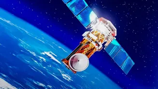
One of the biggest uncertainties in climate models is the effect of clouds and aerosols (tiny particles like dust or soot). They can have both a cooling effect by reflecting sunlight and a warming effect by trapping heat. The EarthCARE satellite, a joint mission by the European and Japanese space agencies launched in May 2024, is designed specifically to tackle this. By using a combination of advanced radar and lidar, it creates detailed 3D profiles of clouds and aerosols from top to bottom. This provides crucial data to refine climate projections and improve the accuracy of weather forecasting, helping us understand how Earth’s energy balance is changing.
An Unprecedented Look at the Poles
Earth's polar regions act as the planet's thermostat, venting heat back into space, but large parts of this process have been a mystery. Much of the heat escapes as far-infrared radiation, a type of energy that had not been systematically measured until now. NASA's PREFIRE mission, consisting of two shoebox-sized CubeSats launched in mid-2024, is now filling this critical knowledge gap. These small but mighty satellites are measuring the far-infrared heat emissions from the Arctic and Antarctic for the first time. This data will help scientists create more accurate models of polar warming, sea ice loss, and how changes at the poles will impact global weather systems. The mission has already been extended through September 2026 to broaden its focus to the entire globe.
Holding Polluters Accountable
Perhaps the most impactful development is the ability of new satellites to track greenhouse gas emissions to their source. Methane, a gas with more than 80 times the warming power of carbon dioxide in the short term, is a key target. Missions like MethaneSAT, launched in 2024, were designed to measure methane concentrations with incredible precision over wide areas. While the satellite ceased communicating after a year, the data it gathered was revolutionary, revealing that emissions from major oil and gas regions were often significantly higher than officially reported. This moves the needle from simply knowing that emissions are rising to identifying exactly who is responsible, creating a powerful tool for accountability and regulation.
What It Means for India
These global advancements have direct implications for India. More accurate data on clouds and aerosols from missions like EarthCARE can significantly improve monsoon forecasting, which is vital for the country's agriculture and water security. Better tracking of Himalayan ice melt via satellites like the Sentinel series provides critical information for managing downstream water resources for millions. Furthermore, satellites that monitor vegetation health, like the recently launched FLEX mission, can assess the impact of heatwaves on crops and help improve agricultural productivity. By combining this new stream of high-resolution data with AI and machine learning, researchers can create more precise models to forecast extreme weather events, manage resources, and build a more climate-resilient future.