




The Annual Monsoon Challenge
For millions living in urban India, the monsoon is a season of contradiction. It offers a welcome respite from the scorching summer heat, yet it also triggers a familiar cycle of disruption. Intense downpours overwhelm decades-old drainage systems, leading
to widespread waterlogging that cripples transportation, damages property, and poses significant public health risks. Traditionally, municipal corporations have relied on reactive measures: deploying pumps after an area is already submerged or clearing blockages found during manual inspections. This approach is like trying to mop up a spill while the tap is still running at full blast—inefficient, costly, and always a step behind the problem.
A Smarter Approach to Water
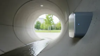
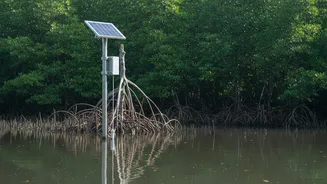
Enter the concept of smart water management, powered by connected sensor networks. Instead of waiting for a crisis to unfold, cities are now embedding technology into their infrastructure to create an urban nervous system. This network consists of hundreds of small, rugged sensors strategically placed across the city in drains, canals, rivers, and low-lying areas. These sensors act as digital sentinels, constantly monitoring environmental conditions in real time. This proactive stance is crucial for transforming flood management from a guessing game into a data-driven science, enabling authorities to anticipate problems rather than just react to them.
How the Sensor Network Works
The technology at the heart of these systems is the Internet of Things (IoT). A typical network uses several types of sensors. Water level sensors, often using ultrasonic technology, measure the height of water in drains and alert officials when it reaches a critical threshold. Rain gauges provide precise data on the intensity and duration of rainfall in different neighbourhoods. Flow meters can track the speed at which water is moving through the drainage system, identifying potential blockages. This data is transmitted wirelessly to a central command centre. There, sophisticated software platforms analyse the incoming information, often integrating it with weather forecasts and historical flooding patterns to generate predictive models.
From Data to Drier Streets
This real-time intelligence is a game-changer for municipal authorities. When the system detects a rapid rise in water levels in a specific drain, it can trigger an automatic alert. This allows officials to dispatch crews to the exact location to clear a potential blockage before it causes widespread flooding. For example, Kolkata has been a pioneer in implementing a comprehensive Flood Forecasting and Early Warning System (FFEWS). This system analyses data to predict which areas are most at risk during a downpour. This information can be used to pre-deploy resources like mobile water pumps, manage traffic diversions, and send out timely alerts to citizens via mobile apps or text messages, advising them to avoid certain routes. The goal is to make decisions in minutes that used to take hours or days, significantly reducing economic losses and improving public safety.
Challenges and the Road Ahead
Despite the immense potential, implementing these systems is not without its hurdles. The initial cost of deploying a city-wide sensor network can be substantial. Ensuring the sensors are protected from vandalism and the harsh urban environment is another key challenge. Furthermore, the system is only as good as the data it collects and the actions taken based on it. This requires not only technological investment but also institutional reform, training for municipal staff, and a clear chain of command for emergency response. However, as the costs of technology decrease and the economic and human costs of urban flooding continue to rise, the case for smart water management becomes stronger every year. These networks are a critical tool in building more resilient, climate-proof cities for the future.