





The Arena for the Battle
The great stage for this climatic contest is the vast tropical Pacific Ocean. Normally, steady easterly trade winds blow from east to west, pushing warm surface water towards Asia and Australia. This allows cooler water from the deep ocean to rise up
near the coast of South America, a process called upwelling. This entire system of atmospheric and oceanic circulation is known as the El Niño-Southern Oscillation, or ENSO. This neutral state is the baseline, the calm before one of our two contenders decides to make a move. The ENSO cycle is irregular, with these events happening every two to seven years and lasting for a year or two.
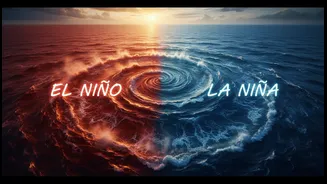
In One Corner: El Niño, the Warm Bringer
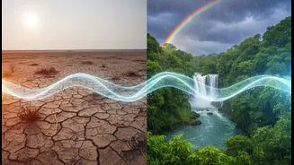
El Niño, which means 'the little boy' or 'Christ child' in Spanish, was named by Peruvian fishermen who noticed the water warming around Christmas. During an El Niño event, the usual trade winds weaken, or even reverse. This allows the massive pool of warm water that is normally in the western Pacific to slosh eastward, towards the Americas. This change has a domino effect. The warmer eastern Pacific heats the air above it, altering atmospheric circulation and shifting rainfall patterns globally. For regions like Indonesia and Australia, it can mean devastating droughts and wildfires. For India, the connection is critical; El Niño is often associated with a weaker monsoon, leading to reduced rainfall and potential drought conditions.
In the Other Corner: La Niña, the Cool Sister
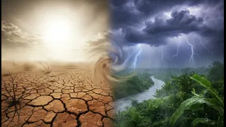
La Niña, meaning 'the little girl', is El Niño's opposite. During a La Niña event, the easterly trade winds become even stronger than usual. They push more warm surface water to the west, enhancing the upwelling of cold water in the eastern Pacific. This results in a strip of cooler-than-average sea surface temperatures across the equatorial Pacific. The global weather impacts are often the reverse of El Niño's. Regions that suffered from drought during El Niño might face flooding, and vice-versa. For India, La Niña is typically a welcome guest. The strengthening of the normal weather patterns is often linked to an enhanced southwest monsoon, bringing normal or even above-normal rainfall, which is vital for the country's agriculture.
The Tug of War and India's Monsoon
The relationship between ENSO and the Indian monsoon is a matter of national importance, but it's not always straightforward. While El Niño years have historically included some of India's worst droughts, not every El Niño causes a poor monsoon. Similarly, La Niña generally brings good rains, but can also contribute to flooding. Scientists have noted that other factors, like warming in the Indian Ocean, also play a significant role, making the monsoon's behaviour more complex. The link between ENSO and rainfall seems to be stronger in North and South India, while the core monsoon zone in Central India shows a weaker correlation in recent decades. This makes forecasting a challenging but crucial task for the nation's farmers and policymakers.
What's Happening in the Ring Now?
The ENSO cycle is in constant flux. After a multi-year La Niña that ended in early 2023, a strong El Niño developed. As of mid-2026, forecasts indicate these El Niño conditions are present and expected to continue strengthening through the winter. Meteorologists around the world, including at the India Meteorological Department, constantly monitor sea surface temperatures and atmospheric pressure to predict which phase is coming next. These forecasts provide crucial months of lead time for governments and industries to prepare for the potential impacts, from managing water resources to preparing for changes in agricultural output.