






The Ground Reality of Choked Drains
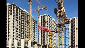
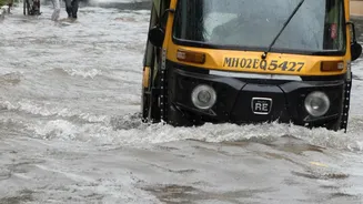
Urban flooding is not merely an act of nature; it is often a man-made disaster. In rapidly expanding cities, natural flood channels and stormwater drains (nullahs) have been systematically built over, turning them into dumping grounds or sites for illegal
construction. These encroachments act like blockades, preventing rainwater from draining away efficiently. During heavy downpours, the water has nowhere to go but onto roads, into homes, and across critical infrastructure. Traditional methods of monitoring, which rely on manual surveys by ground staff, are slow, often inaccurate, and susceptible to corruption, making it difficult to police thousands of kilometres of drainage networks effectively. This leaves cities vulnerable year after year.
An Eye in the Sky
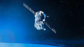
Enter remote sensing technology. By using high-resolution satellite imagery, municipal corporations can get a bird's-eye view of their entire jurisdiction with a frequency and accuracy that ground teams can never match. Satellites from ISRO, such as the Cartosat series, and international missions provide images so detailed that changes as small as a new wall or a pile of construction debris can be identified. This technology moves encroachment detection from a reactive, complaint-based system to a proactive, evidence-based one. Instead of waiting for a flood to reveal a problem, officials can see it developing in near real-time.
How the System Works
The process combines satellite data with Geographic Information System (GIS) mapping and Artificial Intelligence (AI). First, a baseline map is created by overlaying the city's official stormwater drain network onto a high-resolution satellite image. This serves as the 'master file'. Then, new satellite images are captured at regular intervals—monthly, or even more frequently. Sophisticated change-detection algorithms compare the new images to the baseline map. These algorithms are trained to spot changes in land use, such as the appearance of new structures, and flag them as potential encroachments. An alert is then automatically generated and sent to the relevant officials.
From Data to Demolition
The alerts generated are more than just a red flag; they are a dossier of evidence. Typically, an alert includes the precise location of the suspected encroachment, 'before' and 'after' images, and details from land revenue records. This objective, time-stamped proof is crucial for taking legal action and makes it difficult for violators to dispute the claim. Cities like Bhubaneswar have pioneered this approach with systems like the Bhubaneswar Land Use Intelligence System (BLUIS), which monitors government land for any unauthorised changes. Similarly, authorities in Greater Noida, Pune, and Mumbai have begun using satellite and AI-based systems to protect public land and water bodies. The technology provides the irrefutable evidence needed for municipal bodies to issue notices and carry out demolitions with confidence.
Advantages Over Manual Surveys
The benefits of this high-tech approach are manifold. It offers speed and scale, allowing a small team to monitor a vast urban area that would otherwise require hundreds of surveyors. The data is objective, removing the element of human error or intentional oversight. This creates a transparent and auditable record of all changes happening along the city's waterways. Furthermore, it serves as a powerful deterrent. When potential encroachers know the city has a constant watch from above, they are less likely to risk illegal construction. Finally, by identifying blockages early, the system allows for preventative maintenance, saving crores in potential flood damage and relief efforts.
Challenges and the Path Forward
Despite its promise, the technology is not a silver bullet. The cost of high-resolution satellite data can be a hurdle for cash-strapped municipalities. Processing this vast amount of information also requires skilled technicians and robust IT infrastructure. Cloud cover during the monsoon season can sometimes obscure optical satellite imagery, though this can be supplemented with radar satellites that can see through clouds. Ultimately, the success of the technology hinges on political and administrative will. The data is only as good as the action taken on it. Without a commitment to act on the alerts generated, even the most advanced system is ineffective.