


What's Happening on the Ground?
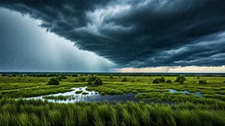
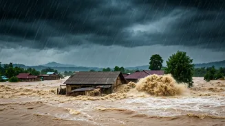
The first wave of monsoon floods for 2026 has severely impacted several northeastern states. In Assam, the situation is particularly grim, with the Assam State Disaster Management Authority (ASDMA) reporting that over 22,000 people across six districts—Dhemaji,
Lakhimpur, Nalbari, Dibrugarh, Chirang, and Kokrajhar—have been affected. Dhemaji is the worst-hit district, with more than 15,000 people grappling with the deluge. The flooding, caused by incessant rainfall in both Assam and the neighbouring state of Arunachal Pradesh, has submerged 96 villages and damaged nearly 1,690 hectares of crops. The rising waters have also caused significant infrastructure damage, including the partial collapse of a railway bridge over the Simen river in Dhemaji, which has forced the suspension of train services on the route. In Arunachal Pradesh, flash floods have led to fatalities and widespread destruction, washing away homes and triggering landslides that have blocked crucial highways. Sikkim has also been hit hard, with heavy rains causing landslides that have cut off road connectivity and washed away a key bridge in the northern part of the state.
Decoding the IMD's Color-Coded Warnings
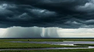
The term 'Orange Alert' has been frequently used in reports, but what does it actually signify? The India Meteorological Department (IMD) uses a four-level, color-coded warning system to alert people to the severity of impending weather events. Green signifies 'All is well,' while Yellow suggests 'Be Aware.' The Orange Alert, which has been issued for several northeastern states, indicates a 'Be Prepared' status. It warns of weather with the potential to significantly impact daily life and cause disruptions to transport, power, and property. Authorities are expected to be prepared for disaster management actions. The highest level is a Red Alert, which means 'Take Action' and signifies extremely bad weather conditions where authorities must take immediate steps to ensure safety. The current Orange Alert for the Northeast warns of heavy to very heavy rainfall, urging residents to remain cautious and vigilant.
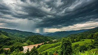
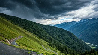
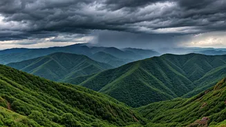
A Region Perennially at Risk
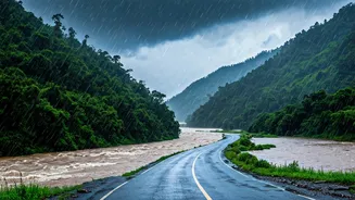
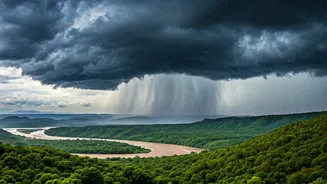
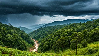
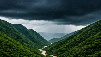
Northeast India's unique topography, crisscrossed by numerous rivers including the mighty Brahmaputra and its tributaries, makes it inherently vulnerable to flooding during the monsoon season. These rivers, many of which originate in the Himalayas, carry massive volumes of water and silt downstream. Heavy monsoon rains cause these rivers to swell, often breaching their banks and inundating the vast plains of Assam. Compounding the issue are the steep, fragile slopes of the surrounding hills in states like Arunachal Pradesh and Sikkim. Deforestation and unchecked construction can destabilize this terrain, leading to frequent and devastating landslides when saturated by continuous rainfall. This combination of riverine flooding in the plains and landslides in the hills creates a recurring cycle of disaster that the region faces annually, posing a constant challenge to life and livelihood.
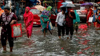
The Human Cost and Official Response
Beyond the statistics of submerged villages and damaged crops lies the profound human impact. In Assam, over 48,000 animals have also been affected by the deluge, a critical blow to the agrarian economy of the region. In Arunachal Pradesh, rescue operations are underway for missing persons after a deadly flash flood. State governments have initiated response efforts. Assam's Chief Minister, Himanta Biswa Sarma, has stated that the government is monitoring the situation in Dhemaji and mobilizing resources for relief and rehabilitation. Authorities in Sikkim are assessing damage and working to clear blocked roads. However, the persistence of rainfall often hampers these efforts. As a precautionary measure, high alerts have been issued in downstream areas, and disaster response forces like the NDRF and SDRF are on standby. For the thousands of displaced people, the immediate future depends on the receding waters and the effectiveness of relief measures.