





The Venus Enigma: A Hellish World Next Door
Often called Earth's twin due to its similar size and density, Venus couldn't be more different. Its surface languishes under a crushing atmospheric pressure 90 times greater than Earth's, at temperatures hot enough to melt lead—around 460 degrees Celsius.
This scorching world is permanently shrouded in thick, opaque clouds of sulfuric acid, making its surface nearly impossible to observe from orbit with conventional cameras. For decades, our understanding has been pieced together from radar maps and data from a handful of Soviet probes that survived the descent in the 1970s and 80s. These missions gave us fleeting glimpses but left major questions unanswered. Was Venus once habitable? Did it have oceans? What are its continents, known as 'tesserae', made of? Answering these requires a new approach: a daring plunge into the inferno.
Enter DAVINCI: A Plunge Into the Unknown
To tackle these mysteries, NASA is preparing the DAVINCI mission, which stands for Deep Atmosphere Venus Investigation of Noble gases, Chemistry, and Imaging. Scheduled to launch in the early 2030s, the mission consists of a spacecraft that will fly by the planet and a sophisticated descent probe designed to survive a 60-minute journey through the atmosphere to the surface. This probe is a flying chemistry lab, equipped to sniff out gases and analyze the composition of the atmosphere layer by layer. But its most anticipated task is to capture the first-ever high-resolution images of Venus’s surface from below the cloud deck. The probe will target a complex, mountainous region called Alpha Regio, one of the mysterious tesserae that may hold the key to understanding Venus's ancient past. These could be the first photos taken of the surface in over 40 years, promising a view comparable to what you'd see from an airplane window on Earth.
Practice Makes Perfect, Even for Space Missions
Before sending a multi-million dollar probe on a one-way trip to another planet, you want to be absolutely sure its instruments work as intended. That’s where the camera practice comes in. The DAVINCI science team can't replicate Venus's extreme heat and pressure on a large scale, but they can simulate the mission's crucial imaging sequence. To do this, they travelled to Crater Island in Utah in June 2026 for a series of dress rehearsals. They loaded a prototype of the probe's camera system into a basket and dangled it from a helicopter on a long cable. The helicopter then performed slow, near-vertical descents from altitudes as high as 18,000 feet, mimicking the probe’s final plunge toward the Venusian surface.
Finding Venus in Our Own Backyard
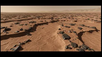
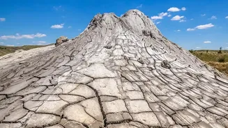
Crater Island, a rugged mountain complex rising from Utah's salt flats, was chosen for its geological resemblance to the terrain DAVINCI will encounter at Alpha Regio. While it lacks the searing heat, its shapes, slopes, and mixture of rock types—from large boulders to smaller fragments—provide a perfect analogue for what the mission's cameras are expected to see. The goal of the helicopter flights wasn't just to test the hardware, but to train the human team. During each 40-minute descent, the near-infrared cameras captured hundreds of images, just as they will on Venus. By stitching these images together, the team practiced creating detailed 3D topographic maps and identifying different rock compositions based on the light they reflect. They then compared their results to existing high-quality geological maps of the Utah site to verify their accuracy.
From Earth Data to Venusian Insights
These field tests are about building confidence and muscle memory. The team treated each helicopter flight like the real deal, evaluating data in real-time and adapting their plans for subsequent flights. By proving they can successfully reconstruct a landscape and its geology using only the descent images from a known Earth location, they can trust that the technique will work on Venus. This meticulous preparation is critical because once the probe enters the Venusian atmosphere, there are no second chances. The data it collects during its hour-long dive will be the only information scientists have to reconstruct the landscape of Alpha Regio in detail. This Earth-based practice ensures that when those precious bytes of data travel millions of miles back home, the team will be ready to translate them into a revolutionary new understanding of our sister world.