







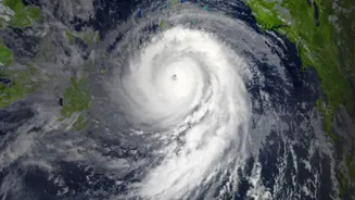
What is the Current Situation?
As of Wednesday morning, November 18, the cyclonic storm 'Akvan' has intensified into a Severe Cyclonic Storm and is located over the west-central Bay of Bengal. According to the India Meteorological Department (IMD), the system was centred about 610
km southeast of Machilipatnam and 610 km south-southeast of Visakhapatnam in Andhra Pradesh. It has been moving very slowly, at about 3 kmph, in a north-northwestward direction. An Orange Message, which is a form of cyclone alert, has been issued for the coasts of Andhra Pradesh and adjoining south Odisha.
The Path from Depression to Cyclone
This weather event began as a low-pressure area over the southeast Bay of Bengal around November 14. Favourable atmospheric conditions and warm sea surface temperatures allowed it to strengthen progressively. It first concentrated into a depression, which is a sign of falling air pressure and strengthening winds. By the evening of November 16, the system had intensified enough to be classified as a Cyclonic Storm and was officially named Akvan, a name contributed by Iran. The journey from a low-pressure area to a cyclonic storm is a standard meteorological progression that the IMD tracks closely to provide timely warnings.
IMD's Official Forecast and Timeline
The IMD predicts that Akvan will continue to intensify. It is expected to become a Very Severe Cyclonic Storm by the morning of November 19. The forecast indicates the storm will continue to move northwestwards, heading towards the Andhra Pradesh coast. The projected landfall is expected to occur around noon on November 20. The storm is anticipated to cross the coast between Nellore and Tuni in Andhra Pradesh. At the time of landfall, it is predicted to be a Very Severe Cyclonic Storm with maximum sustained wind speeds of 120-130 kmph, with gusts reaching up to 145 kmph.
Potential Impact and Affected Areas
The primary areas of concern are coastal Andhra Pradesh and Yanam. These regions are expected to bear the brunt of the storm, with predictions of extremely heavy rainfall on November 19 and 20. The state government has already placed coastal districts on high alert. Neighbouring states are also preparing for the storm's influence. Odisha has issued alerts for its southern districts, anticipating heavy rainfall and potential landslides in hilly areas. Parts of Telangana and West Bengal may also experience rainfall between November 19 and 21. The IMD has issued a stern warning to fishermen, advising them to stay out of the Bay of Bengal as sea conditions will be extremely rough.
How to Stay Safe and Prepared
With a major storm approaching, preparedness is key. The IMD issues warnings in stages—a Pre-Cyclone Watch, followed by a Cyclone Alert (Yellow) and a Cyclone Warning (Orange)—to give residents time to prepare. It is crucial to follow official updates from the IMD and local authorities, and to disregard rumours. Residents in vulnerable, low-lying coastal areas should be ready to evacuate if orders are given. Preparing an emergency kit with essentials like non-perishable food, drinking water, medications, and a charged power bank is highly recommended. Before the storm hits, secure loose objects outside your home, like furniture or signboards, as they can become dangerous projectiles in high winds.