





The Pacific's Warm Heartbeat
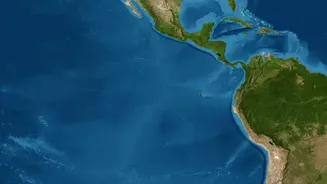
At its core, El Niño is a simple phenomenon: the unusual warming of sea surface waters in the central and eastern tropical Pacific Ocean. It’s one phase of a larger, naturally recurring cycle known as the El Niño-Southern Oscillation, or ENSO. Think of it as the climate’s
irregular heartbeat. In a normal year, strong trade winds blow from east to west, piling up warm water in the western Pacific, near Asia and Australia. During an El Niño, which occurs every two to seven years, these winds weaken or even reverse. This allows the massive pool of warm water to slosh back eastward, toward South America, fundamentally changing ocean temperatures and, as a result, global weather patterns.
How a Warm Pacific Changes the Air
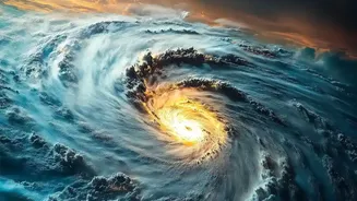
This shift in ocean heat triggers a massive atmospheric domino effect. The engine behind this is a vast, looping pattern of air called the Walker Circulation. Normally, the warm water pooled in the western Pacific heats the air above it, causing it to rise and form clouds, leading to rain. This air then travels eastward high in the atmosphere, cools and sinks over the colder eastern Pacific, and finally flows back west along the surface, completing the loop. This circulation is a critical driver of weather in the tropics. When El Niño moves the warm water east, the area of rising, moist air moves with it. This disrupts the entire Walker Circulation, weakening or even reversing the flow. The consequence is that regions that are usually wet can become dry, and vice versa.
Why India Feels the Disruption
India’s southwest monsoon is intricately linked to these global pressure patterns. The normal Walker Circulation helps maintain a low-pressure system over the Indian subcontinent, which is essential for pulling moisture-laden winds from the Indian Ocean onto the land. When El Niño disrupts this circulation, it often creates higher-than-normal atmospheric pressure over India and suppresses the upward movement of air that is needed to form monsoon clouds. The powerful engine that drives the monsoon loses steam. This connection was first identified over a century ago by Gilbert Walker himself while studying the Indian monsoon. The result is a strong historical correlation: an El Niño year significantly increases the probability of a weaker, delayed, or deficient monsoon in India.
From Fields to Finances
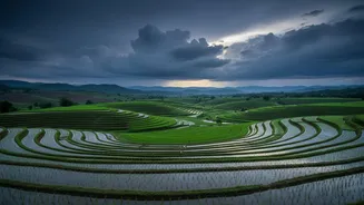
A weak monsoon is not just a weather report; it is a national economic and social event. Nearly half of India's workforce is employed in agriculture, and a significant portion of the country's farmland is rain-fed, meaning it lacks irrigation. A poor monsoon can lead to delayed planting and reduced yields for crucial kharif crops like rice, cotton, and soybeans. This directly impacts farmers' incomes and can lead to widespread rural distress. The ripple effects are felt across the economy. Lower agricultural output can fuel food price inflation, affecting household budgets nationwide. Water reservoirs don't get fully replenished, straining supplies for drinking water and reducing output from hydroelectric power plants, which can lead to power shortages. In short, a rainfall deficit can shave points off India's GDP growth.
The Wild Card: The Indian Ocean Dipole
However, the relationship isn't perfectly linear. Not every El Niño year results in a drought. India's weather has its own local hero: the Indian Ocean Dipole (IOD), sometimes called the 'Indian Niño'. The IOD is a similar ocean-atmosphere phenomenon, but it plays out within the Indian Ocean. It has three phases, but the 'positive' phase is the crucial one. During a positive IOD, the western Indian Ocean near Africa becomes warmer than the eastern part near Indonesia. This temperature difference can create a low-pressure system close to India, boosting the monsoon winds and delivering more rainfall, sometimes powerfully enough to counteract El Niño's negative influence. The 1997 'super El Niño', for example, was expected to cause a severe drought, but a strong positive IOD emerged and India received normal rainfall.