










A Shared Eye on a Shared Planet
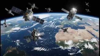
The BRICS bloc, comprising Brazil, Russia, India, China, and South Africa, along with its newer members, has embarked on an ambitious space venture: the BRICS Remote Sensing Satellite Constellation. This isn't about launching a single new satellite but
creating a 'virtual constellation' by pooling data from existing satellites operated by member countries. The formal agreement, signed in August 2021, allows the space agencies of these nations to create a data-sharing mechanism. This network includes contributions like India's Resourcesat-2 and 2A satellites, China's Gaofen-6, and Russia's Kanopus-V, among others. The goal is to provide a steady stream of high-quality earth observation data to all members, enabling them to tackle common challenges.
What is Remote Sensing?
Remote sensing is the science of gathering information about the Earth's surface from a distance, typically using satellites or aircraft. These platforms are equipped with sensors that detect energy reflected from the Earth. By analysing this data, scientists can monitor changes in land use, track forest cover, measure soil moisture, and observe ocean temperatures. For instance, Indian satellites like the CartoSAT and Resourcesat series are already used to provide high-resolution imagery for assessing risks from floods, droughts, and cyclones. This technology allows for continuous, large-scale monitoring that would be impossible from the ground, providing crucial information for everything from agriculture to disaster management.
Monitoring Climate Threats from Above
The BRICS nations face a wide array of climate-related threats, making this collaboration particularly vital. Satellite data can be used to monitor the melting of Himalayan glaciers, a concern for both India and China. It can track the increasing frequency of forest fires in Russia and Brazil, assess desertification in South Africa, and provide early warnings for cyclones and floods across the Indian subcontinent. By sharing data, a satellite that passes over a drought-stricken area in Brazil can provide valuable insights for Indian agricultural planners facing similar conditions. This collective approach strengthens each nation's ability to forecast, prepare for, and respond to climate-induced disasters, ultimately protecting lives and livelihoods.
Geopolitics and Future Prospects
This space cooperation is more than just a technical agreement; it's a significant geopolitical development. By building their own data-sharing network, the BRICS nations are reducing their reliance on Western-controlled satellite systems and fostering strategic autonomy. The initiative represents a form of 'space diplomacy' that strengthens ties within the bloc. Recent meetings in Bengaluru, hosted by ISRO, have focused on expanding the constellation to include new BRICS members like Egypt, Iran, and the UAE, and even establishing a BRICS Space Council to institutionalize the collaboration. While challenges like harmonizing data standards and navigating political differences remain, the project signals a clear ambition to build a parallel infrastructure for a multipolar world.