







Meet GRITSS: The Ultimate Reference Point
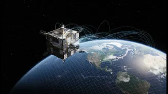
At the heart of this leap forward is a suitcase-sized satellite called GRITSS, which stands for Geodetic Reference Instrument Transponder for Small Satellites. Launched in early July 2026, its mission isn't to become a new GPS, but to make the entire
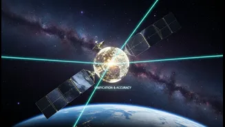
existing global positioning framework vastly more accurate. It does this by acting as a single, unified target in orbit that can be observed by three different and traditionally separate measurement systems on the ground. Think of it as a master translator, allowing different systems to finally speak the same language with unprecedented clarity. The goal is to perfect the International Terrestrial Reference Frame (ITRF), which is the fundamental grid system for all Earth observation and navigation.
Solving a Planetary Communication Problem
Currently, the ITRF is built by combining data from three main techniques: the Global Navigation Satellite System (GNSS), which includes GPS; Satellite Laser Ranging (SLR), which bounces lasers off satellites; and Very Long Baseline Interferometry (VLBI), which uses radio telescopes to observe distant cosmic objects. The problem is that tying the data from these separate ground networks together introduces tiny but significant errors, often measured in millimetres. GRITSS solves this by orbiting as a common denominator. It carries a special receiver that captures GPS signals, converts them into a frequency that VLBI radio telescopes can read, and rebroadcasts them. Simultaneously, it has a laser retroreflector, allowing SLR stations to get a precise distance measurement. By creating a direct, space-based link, it eliminates the ground-based guesswork.
The Promise of Millimetre-Level Accuracy
The ultimate ambition for the GRITSS mission is to help achieve an ITRF with 1-millimetre accuracy. This may sound small, but for science and technology, it's a monumental leap. Such precision is essential for tracking the subtle but critical indicators of climate change, like the melting of polar ice sheets, tiny shifts in sea level, and the rise or fall of land masses. For a country like India, with its vast coastline and reliance on Himalayan glaciers, this level of detail is vital for future climate modelling and disaster management. It will enable scientists to more accurately measure groundwater depletion and land subsidence in major urban areas. This extreme accuracy is maintained through incredible engineering; the satellite uses thermal controls to keep its internal temperature stable to within a single degree Celsius, ensuring its timing doesn't drift by more than a trillionth of a second.
Beyond Better Maps: The Impact for India
While climate science is a major beneficiary, the impact of a more stable and reliable navigation grid will be felt across many industries. For the burgeoning fields of autonomous vehicles, advanced drone logistics, and precision agriculture, unwavering accuracy is not a luxury—it's a necessity. A hyper-accurate reference frame allows for the creation of next-generation topographic maps with unprecedented detail, which has profound implications for urban planning and infrastructure development in a rapidly growing nation. Furthermore, it provides a stronger foundation for India's own regional navigation satellite system, NavIC. As India's reliance on geospatial data continues to grow, GRITSS and the improvements it brings will ensure the underlying quality of that data can keep pace with innovation, securing a more robust digital future.