
A Gateway to India's Space Future
The Indian National Space Promotion and Authorization Centre (IN-SPACe) is rapidly becoming a cornerstone of India's space ambitions. Acting as the bridge between ISRO and the private sector, its mandate is to grow the nation's space economy. A key part
of that mission is nurturing talent. By offering specialized, free online courses, IN-SPACe is directly investing in the next generation of engineers, scientists, and entrepreneurs who will lead India's charge in the global space industry. These programs are designed to equip students with cutting-edge skills that are in high demand, making them more than just an academic exercise; they are a direct pathway to a promising career.
Demystifying Synthetic Aperture Radar (SAR)
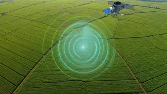
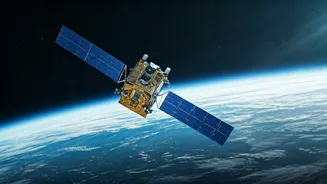
So, what exactly is this technology? Synthetic Aperture Radar, or SAR, is a powerful form of remote sensing. Unlike traditional optical satellites that are essentially cameras in space, SAR is an active sensor that sends out its own microwave signals and reads what bounces back. Think of it as a bat's echolocation, but for a satellite. Its superpower is its ability to 'see' through clouds, fog, and even darkness. This means it can provide reliable, high-resolution imagery of the Earth's surface 24/7, regardless of weather conditions—a capability that is revolutionizing how we monitor our planet.
What the Course Covers
The IN-SPACe course, often conducted as part of its broader outreach and training initiatives, is designed to provide a strong foundation in SAR technology. Students can expect to learn the fundamental principles behind how SAR works, from signal properties to imaging geometry. The curriculum typically delves into processing and interpreting SAR data, helping you understand what the different shades and textures in a radar image actually mean. The goal is to move from theory to practical application, enabling you to convert raw data into actionable insights for various real-world scenarios.
Real-World Impact and Applications
The applications for SAR are vast and incredibly important for a country like India. During natural disasters like floods or landslides, SAR can map the affected areas in near-real-time, even when heavy rain and cloud cover would blind other satellites. This is critical for effective disaster management and response. In agriculture, it helps monitor crop health, soil moisture, and forecast yields, boosting food security. Furthermore, SAR is used for urban planning, monitoring deforestation, tracking glacial melt in the Himalayas, and for national security and surveillance purposes. Learning SAR means learning a skill that can have a direct, positive impact on society.
The Career Advantage It Provides
For students in engineering, geoinformatics, environmental science, and related fields, proficiency in SAR is a significant career differentiator. India's space sector is booming, with private startups like Pixxel and SatSure Analytics, alongside government bodies like ISRO and DRDO, actively hiring professionals with remote sensing skills. Job listings frequently call for experience in SAR data processing and analysis for roles such as Geospatial Analyst, Remote Sensing Engineer, and Data Scientist. With the upcoming launch of the joint NASA-ISRO SAR (NISAR) mission, which will provide a massive amount of open-access data, the demand for SAR experts is projected to skyrocket. Completing this course signals to employers that you are ahead of the curve.