








India's Ocean Eyes in Orbit
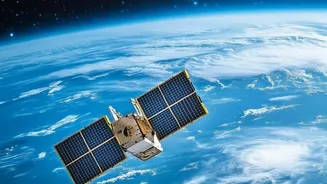
The OceanSat series is a fleet of Indian Earth observation satellites, designed, built, and operated by the Indian Space Research Organisation (ISRO) specifically for oceanographic and atmospheric studies. The journey began with Oceansat-1, launched back
in 1999, which carried an Ocean Colour Monitor (OCM). This was followed by Oceansat-2 in 2009, which provided crucial continuity with enhanced instruments. The latest in this lineage is Oceansat-3, also known as EOS-06, which was successfully launched in November 2022. These satellites are equipped with advanced sensors designed to capture a wealth of data about the ocean's surface, including its colour, temperature, and even wind patterns. Their primary mission is to provide systematic data that has a wide range of applications, from weather forecasting to, most critically for coastal communities, identifying potential fishing zones.
The Science of Colour and Catch
How can a satellite hundreds of kilometres above Earth know where fish are likely to be? The secret lies in the colour of the water. The ocean's colour changes from deep blue to greener shades based on the concentration of phytoplankton—microscopic marine algae. These tiny plants contain chlorophyll, which is essential for photosynthesis. Just like on land, phytoplankton form the very base of the marine food chain. They are eaten by zooplankton, which are then consumed by small fish, which in turn are prey for larger, commercially valuable fish. The OceanSat satellites are equipped with an Ocean Colour Monitor (OCM) that can detect the specific spectral signature of chlorophyll. By identifying areas with high chlorophyll concentration, scientists can map out nutrient-rich waters where phytoplankton are blooming. These blooms are hotspots for marine life, making them Potential Fishing Zones (PFZ).
From Satellite Data to Fisherman's Map
The raw data captured by OceanSat is just the first step. This information is downlinked to ISRO and then relayed to the Indian National Centre for Ocean Information Services (INCOIS) in Hyderabad. At INCOIS, scientists combine the ocean colour data with other crucial information, like Sea Surface Temperature (SST), which is also a key indicator for where specific fish species congregate. Using this combined data, INCOIS generates detailed Potential Fishing Zone (PFZ) advisories. These are essentially maps that pinpoint the exact coordinates—latitude and longitude—of likely fish aggregation spots. To make this information accessible to the nearly 7 million people in India's coastal communities, these advisories are disseminated daily through a variety of channels. This includes electronic display boards at fishing harbours, dedicated mobile apps, and text messages, often in local languages.
Real-World Impact and Economic Benefits
The impact of these PFZ advisories has been transformative. For fishermen, the biggest challenge is often not the act of fishing, but the time and fuel spent searching for fish. By providing precise locations, the OceanSat data drastically reduces this search time. Studies have shown that this leads to significant savings on diesel, a major operational cost for boat owners. One study in Maharashtra reported that a single fishing village saved 70,000 litres of diesel in a month by using PFZ advisories. The increased efficiency translates directly into higher profits, with some studies indicating that catch-per-unit-effort can increase by two to four times. This technological intervention not only improves the livelihood and socio-economic status of fishing communities but also contributes to environmental sustainability by reducing fuel consumption and carbon emissions.