






Real-Time Disaster Management
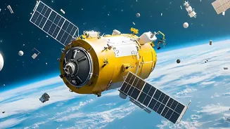
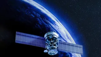
One of the most critical applications for India's EOS program is in disaster management. Satellites like EOS-05, a geo-imaging satellite, are designed for near-continuous observation of large geographical areas. This is a game-changer during rapidly developing
natural disasters such as cyclones, floods, and forest fires. Unlike satellites in lower orbits that pass over a location periodically, a geostationary satellite can provide repeated imagery of the Indian subcontinent, helping authorities monitor the situation as it unfolds. This allows for more effective response coordination, quicker damage assessment, and the timely dissemination of warnings to vulnerable populations, significantly strengthening the nation's ability to manage emergencies.
Enhancing Agricultural Productivity
Agriculture remains the backbone of the Indian economy, and Earth observation satellites play a vital role in its modernization. Data from these spacecraft is used for a wide range of applications, including estimating crop acreage, monitoring crop health, and assessing soil moisture levels. For instance, radar imaging satellites like EOS-04 (RISAT-1A) can see through clouds, a crucial feature during the monsoon season, to provide reliable data on rice cultivation and other key crops. This information helps in creating pre-harvest production estimates, planning water use, and providing crucial inputs for crop insurance schemes, ultimately supporting food security and the livelihoods of millions of farmers.
Strengthening National Security
The ability to monitor the Indian subcontinent and its adjoining regions day and night, under all weather conditions, is a significant strategic asset. The advanced imaging capabilities of the EOS series have clear applications for border surveillance and monitoring maritime activities. The detailed, near real-time imagery helps security forces keep a close watch over vast and often inaccessible terrains. According to reports, the EOS-05's capabilities are intended for both civilian and strategic use, providing a crucial layer of intelligence for national security requirements.
Supporting Urban and Rural Development
As India continues to grow, managing its urban and rural landscapes effectively is paramount. Satellite data provides invaluable insights for urban planners, helping them monitor urban sprawl, map land use changes, and plan for infrastructure development. In rural areas, the data is just as critical. It's used for projects like the National Database for Emergency Management (NDEM) and for mapping hydro-geomorphological features to locate underground water resources for drinking water missions. This 'big picture' view allows for more sustainable and evidence-based development planning across the country.
Protecting Forests and the Environment
India's rich biodiversity and natural resources require constant monitoring for their preservation. Earth observation satellites are powerful tools for environmental management. They help in mapping forest cover, detecting deforestation, and tracking forest fires in near real-time. This data is essential for forestry management, biodiversity characterisation, and analysing environmental impact. By providing consistent and large-scale data, satellites like those in the EOS series support India's efforts to protect its ecological treasures and manage its natural resources sustainably for future generations.