


Seeing the Unseen with SAR
Before diving into the training, it’s important to understand what makes Synthetic Aperture Radar (SAR) so special. Unlike traditional optical satellites that work like cameras and need clear skies and daylight, SAR is an active remote sensing technology.
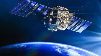
It sends out its own microwave pulses and reads the echoes that bounce back. This gives it superpowers: it can 'see' through clouds, heavy rain, and complete darkness. For a monsoon-heavy country like India, this all-weather, day-and-night capability is a game-changer. ISRO has been a key player in this field, with its series of Radar Imaging Satellites (RISAT) providing crucial data and the upcoming NASA-ISRO SAR (NISAR) mission promising to take this to a new level. But having the satellites is only half the battle; you need skilled people who can understand and use the data they generate.
The Hub of Expertise: IIRS Dehradun
This is where the Indian Institute of Remote Sensing (IIRS) comes in. Established in 1966 and now a constituent unit of ISRO in Dehradun, IIRS is India’s premier institution for capacity building in geospatial technologies. As part of ISRO's broader mission to foster a robust space ecosystem, IIRS designs and conducts training programmes for a wide range of participants. These courses cater to everyone from university students and researchers to government officials and industry professionals. The goal is to equip them with the knowledge to effectively use space-based data for national development. The courses range in duration from short one-week programmes to comprehensive two-year master's degrees, covering all facets of remote sensing.
From Theory to Hands-On Skill Building
The SAR training programmes are meticulously designed to move beyond textbooks and lectures. They focus on building tangible, practical skills. IIRS offers a variety of formats, including free Massive Open Online Courses (MOOCs) that make learning accessible to a vast audience, as well as intensive, in-person workshops. A recent example was an advanced course on SAR technologies organised jointly with the European Space Agency (ESA). Participants in these courses don't just learn the theory; they get their hands dirty. The curriculum includes hands-on training with real-world case studies, using data from ISRO's own satellites and other international missions. They learn to use specialised software and advanced techniques like polarimetry (PolSAR) and interferometry (InSAR) to process and analyse complex data, turning raw satellite signals into actionable intelligence.
Real-World Impact Across Sectors
The practical skills gained through this training have a direct and significant impact across numerous critical sectors in India. For disaster management, SAR is invaluable. Experts can use it to map the extent of flooding during a cyclone, even through dense cloud cover, or to detect subtle ground shifts that might predict a landslide. In agriculture, SAR data helps in monitoring crop health and soil moisture levels, contributing to precision farming and better yield estimation. The technology is also vital for environmental monitoring, allowing authorities to track deforestation, study glacier melt in the Himalayas, and manage forest resources. By training professionals in these applications, ISRO ensures that India can fully leverage its space assets for everything from public safety and food security to strategic surveillance and urban planning.
Powering India’s Future Space Economy
Ultimately, ISRO’s capacity-building initiatives, including its SAR training, are about more than just a single technology. They are a strategic investment in the nation's future. As India's space sector opens up to private players and startups, the demand for a highly skilled workforce is skyrocketing. These training programmes create a talent pipeline, equipping a new generation with the advanced skills needed to innovate and lead. By turning students into specialists and professionals into experts, ISRO is laying the foundation for a self-reliant and globally competitive space economy. It ensures that as our presence in space grows, so does our ability to use that vantage point to solve problems right here on Earth.