


IMD's Official Warning Levels
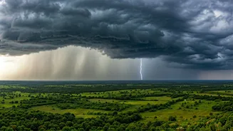
The India Meteorological Department (IMD) has placed several regions under red and orange alerts as the monsoon strengthens. A red alert signifies a warning to “take action,” anticipating extremely heavy rainfall that could disrupt daily life. An orange alert advises
residents to “be prepared” for heavy to very heavy showers. These alerts are active for the next 48 hours as favorable conditions are expected to push the monsoon further into Gujarat, Madhya Pradesh, Uttar Pradesh, and Uttarakhand over the next few days. The intensification is driven by an upper air cyclonic circulation over north Telangana and a trough running from Coastal Andhra Pradesh to Madhya Maharashtra, which are actively pulling moisture from the sea.
Regions on High Alert
The warnings cover a wide expanse of the country. A red alert for extremely heavy rainfall has been issued for Sub-Himalayan West Bengal and Sikkim. Red alerts are also in effect for North Coastal Andhra Pradesh and the districts of Kokrajhar and Chirang in Assam. An orange alert is active for several other northeastern states including Assam, Meghalaya, and Arunachal Pradesh. In the south, heavy to very heavy rainfall is expected in Coastal Karnataka, Kerala, Tamil Nadu, and Telangana. Specifically in Telangana, districts including Hyderabad, Rangareddy, and Medak are bracing for heavy spells accompanied by thunderstorms. The west coast, particularly Konkan and Goa, is also forecast to receive widespread and heavy showers.
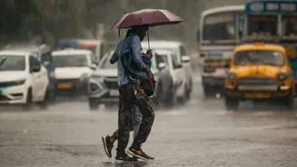
Essential Safety and Preparedness Tips
With heavy rains forecast, authorities are urging residents to take precautions. People in low-lying areas should be vigilant about waterlogging and potential flooding. It is crucial to avoid flooded streets and dangerous, dilapidated structures. Before the rains intensify, check for loose electrical wiring around your home and ensure your emergency kit is stocked with essentials like a torch, batteries, food, and water. For those in vulnerable hillside areas, it is important to watch for any signs of landslides. Commuters and travelers should plan their journeys carefully, as heavy downpours can lead to significant traffic disruptions and travel delays. It is advisable to stay updated with the latest advisories from the IMD and local disaster management authorities.
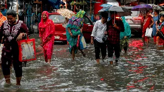
Impact on Travel and Daily Life
The expected downpours are likely to affect normal life and travel across the alerted regions. Waterlogging has already been reported in parts of Mumbai, impacting traffic and local train services. Fishermen have been strongly advised not to venture into the sea along and off the coasts of Konkan, Goa, and Karnataka due to rough sea conditions and strong winds. In urban areas, residents can expect traffic snarls and delays. In rural and hilly regions, the risk of landslides poses a threat to road connectivity. Authorities are on high alert to manage potential disruptions to power supply and transport networks, advising citizens to avoid unnecessary travel during periods of intense rainfall.
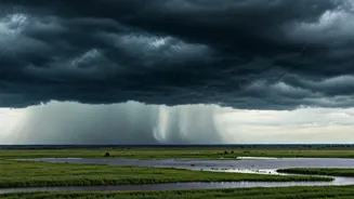
The Monsoon's Progress This Season
After a somewhat delayed start and a slowdown in mid-June, the southwest monsoon is now advancing with renewed vigour. It has recently moved into more parts of Gujarat and Madhya Pradesh, and covered the remaining areas of Maharashtra, Chhattisgarh, and Jharkhand. Despite this recent surge, the nationwide rainfall since the beginning of the season remains below normal. However, the current active phase is expected to help reduce the deficit in several regions. The monsoon's advance into North India, including Delhi-NCR, is anticipated around the first week of July, bringing much-awaited relief from the heat.